Every property.
One place.
Look up any Australian address and get title, zoning, live Development Applications, government reports and a CAD-ready site drawing, without juggling seven council portals.
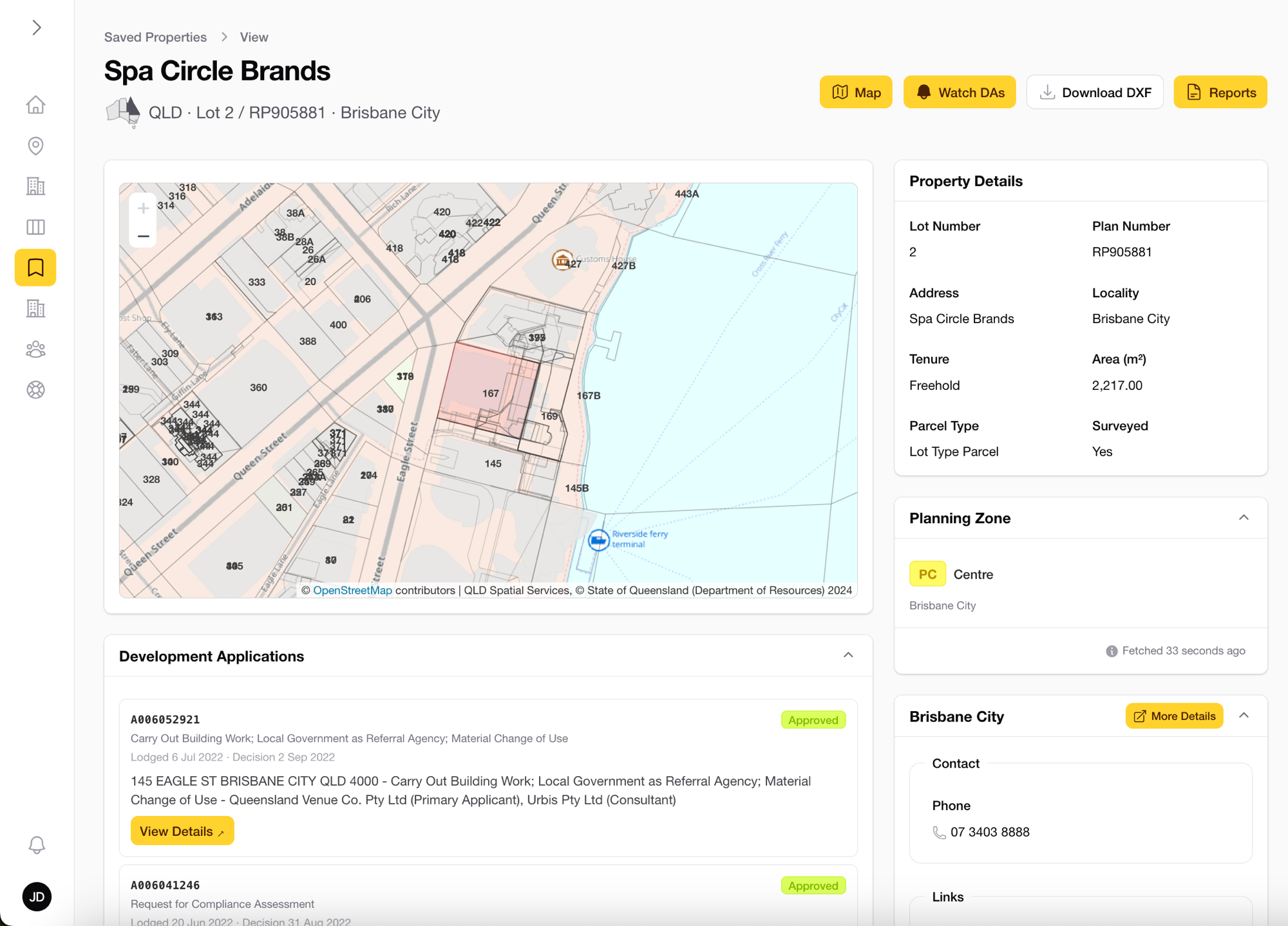
See exactly what you'd get.
Everything below is the live app on one real address: title, DAs, boundaries, underground services and reports, the way your team works it.
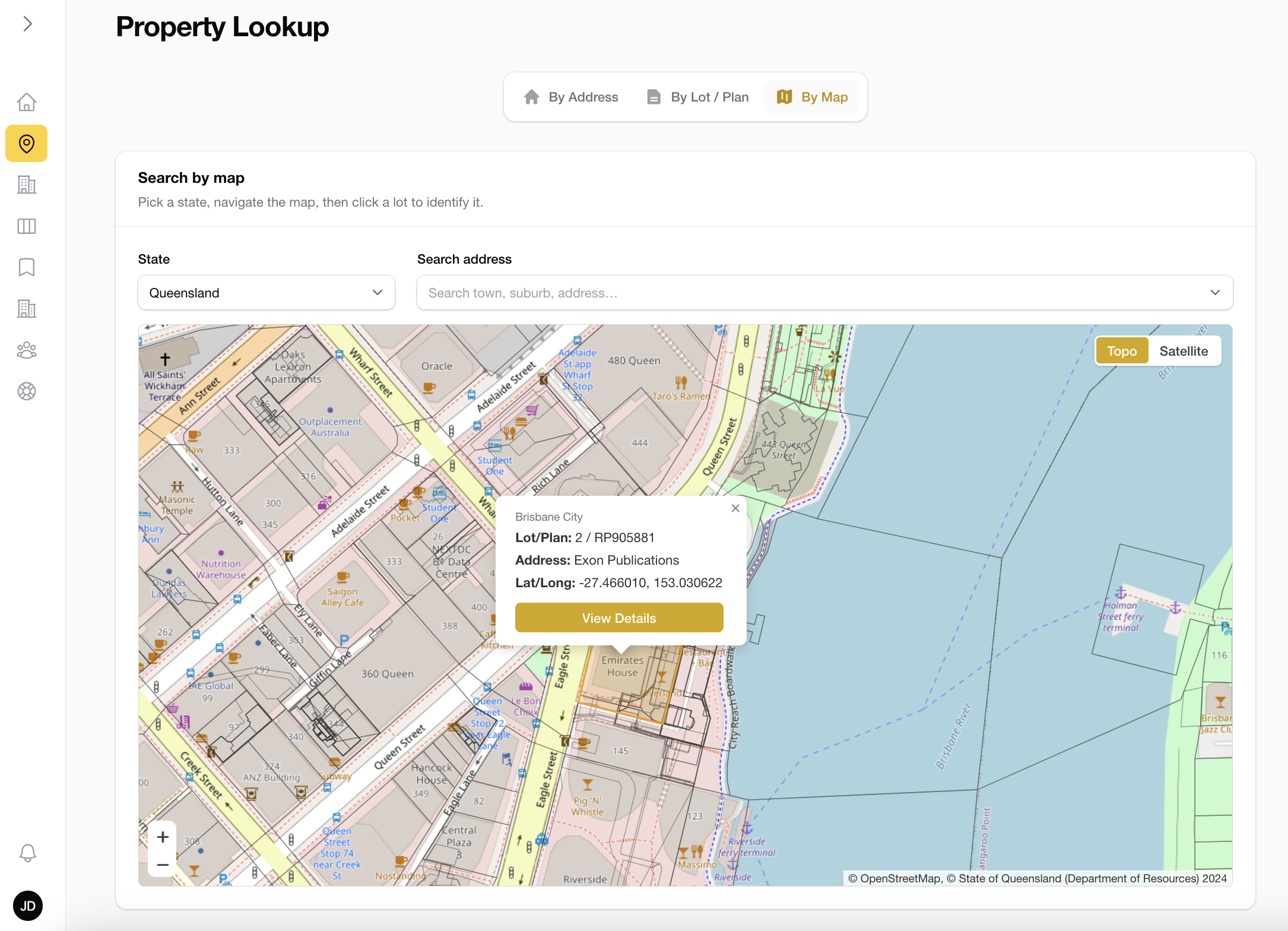
Find any property in seconds
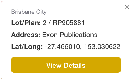
Type an address, a lot/plan, or click straight on the map. Title, cadastre and zoning resolve instantly, across all 8 states and territories.
- ✓Search by address, lot/plan or map pin
- ✓Topographic & satellite base layers
- ✓Exact lot boundaries in every state
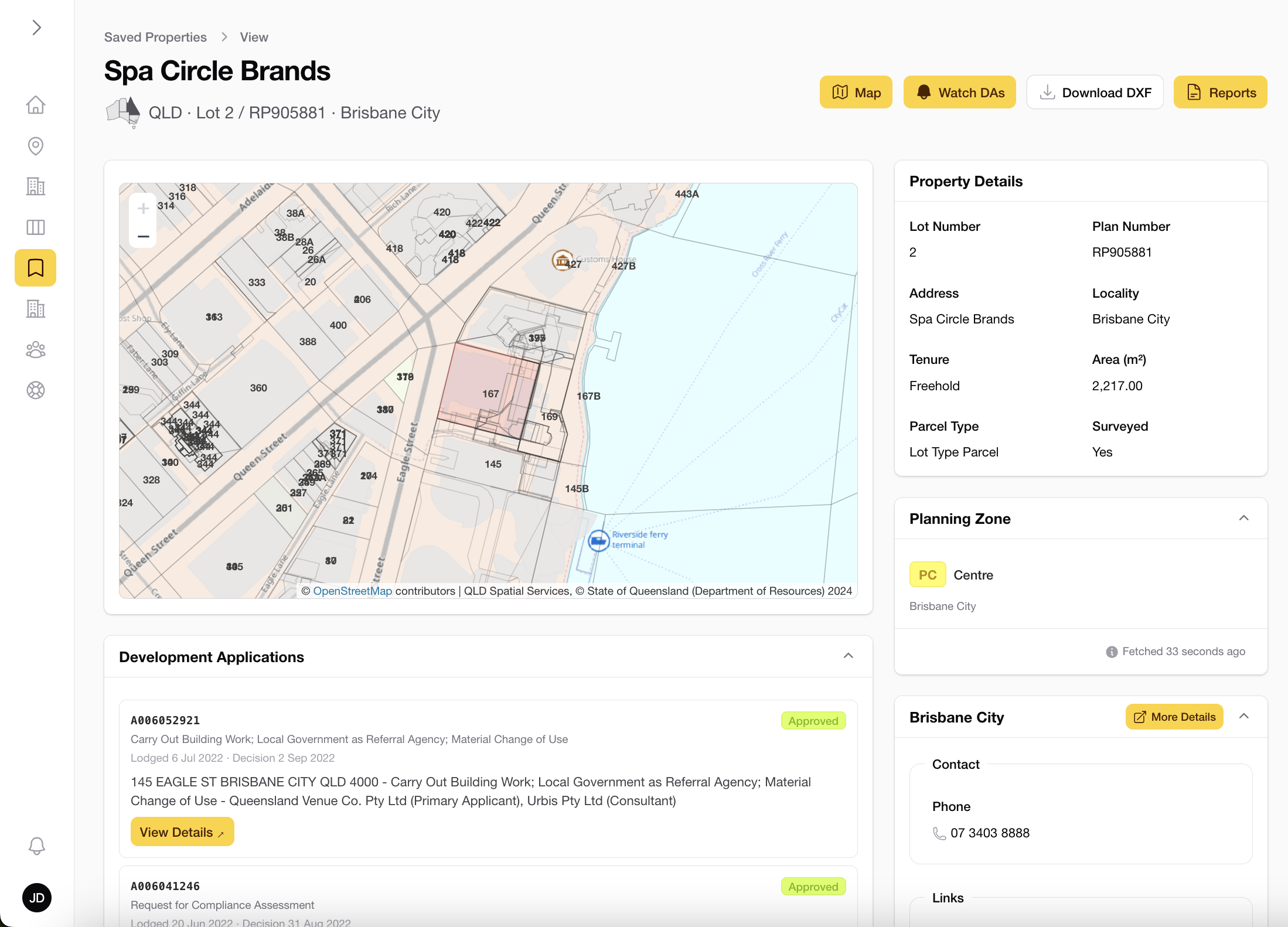
Every detail on one screen
Lot and plan numbers, tenure, area, parcel type and the live planning zone: all assembled the moment you open a property.
- ✓Title, area & tenure at a glance
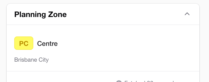
- ✓Planning zone with overlay codes
- ✓Council contacts attached to every lot
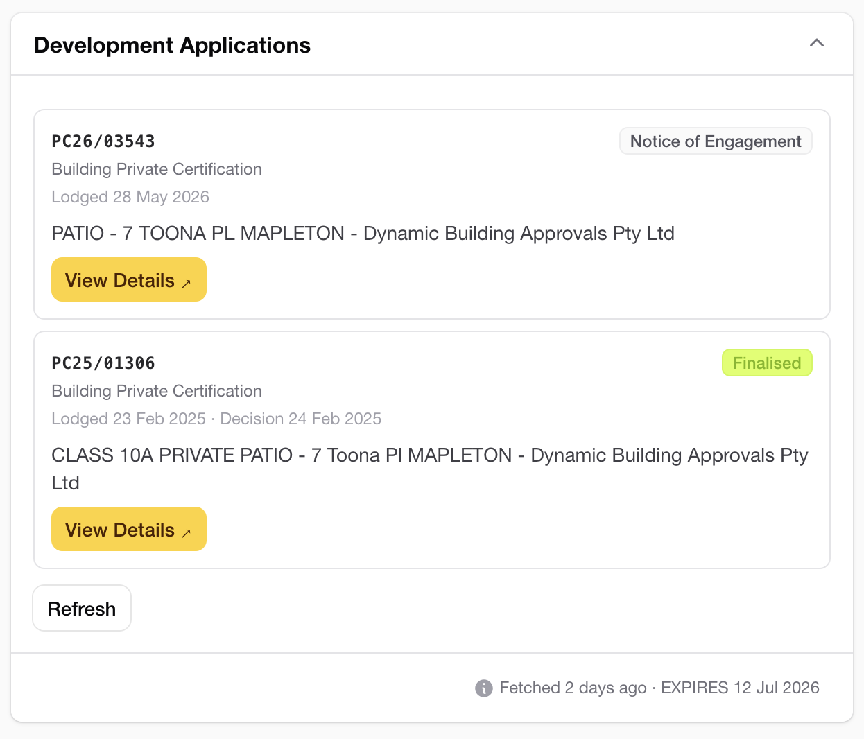
Track Development Applications live
New lodgements, status changes and decisions across 252+ councils, sourced directly from each council's own system. Not a national scraper.
- ✓Live feeds from 252+ councils
- ✓Status from Lodged to Finalised
- ✓Watch any property for new DAs
Download DXF boundaries and hazard overlays in one click
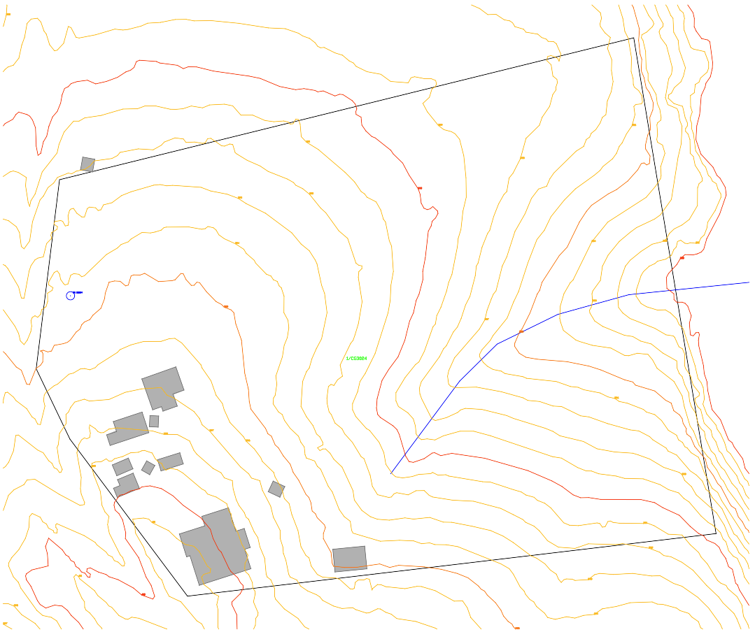
Hand your draftspeople a clean, layered DXF: boundary, buildings, contour lines labelled with elevations, watercourses, water bores and hazard overlays (flood, bushfire, landslide, coastal), ready to drop straight into AutoCAD or Civil 3D.
- ✓Layered DXF, ready for Civil 3D
- ✓Contours with elevation labels
- ✓Watercourses in every state, water bores where the state publishes them
- ✓Flood, bushfire & other hazard overlays
Know what affects the lot before you quote
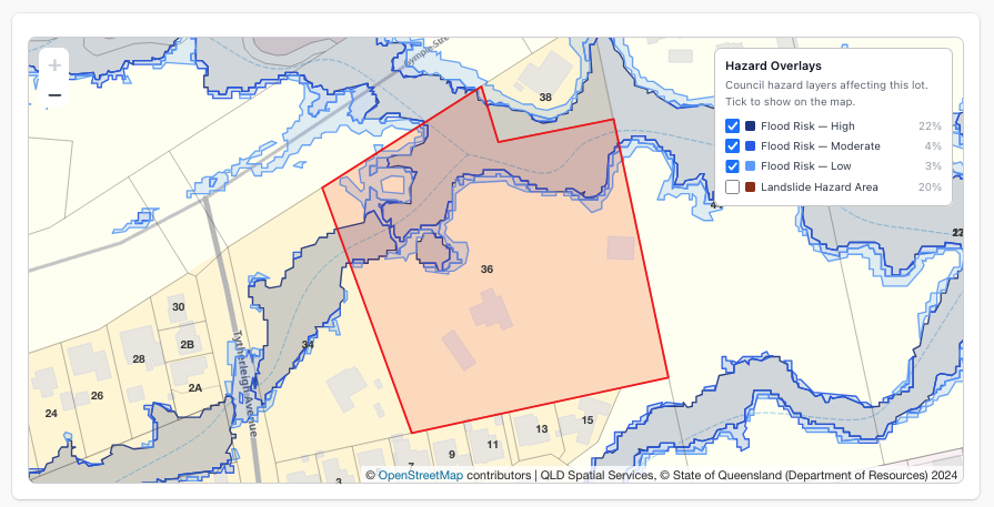
Flood, bushfire, landslide and coastal hazard layers drawn straight over the parcel, with the share of the lot each one covers. State planning layers everywhere, replaced by the council's own flood study wherever one is published.
- ✓Affected or not, with percentage of the lot
- ✓Toggle any layer on the property map
- ✓Exported as selectable DXF layers
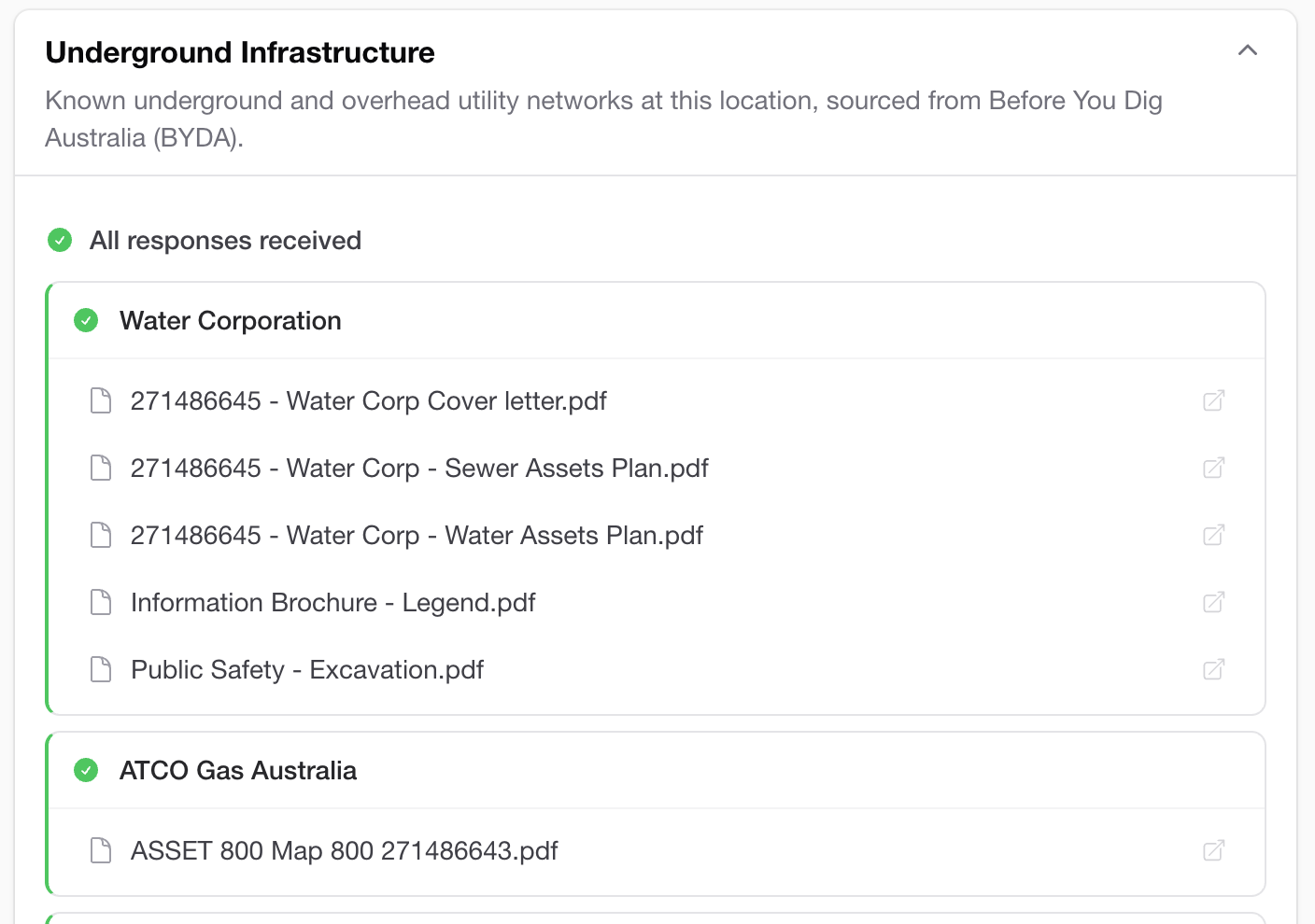
BYDA enquiries, lodged for you
One click lodges a real Before You Dig Australia enquiry on the property and collects every utility response PDF as it lands: water, gas, power and comms plans, attached to the property record.
- ✓Real BYDA enquiry, no separate portal
- ✓Asset-owner PDFs collected automatically
- ✓Notified the moment all responses land
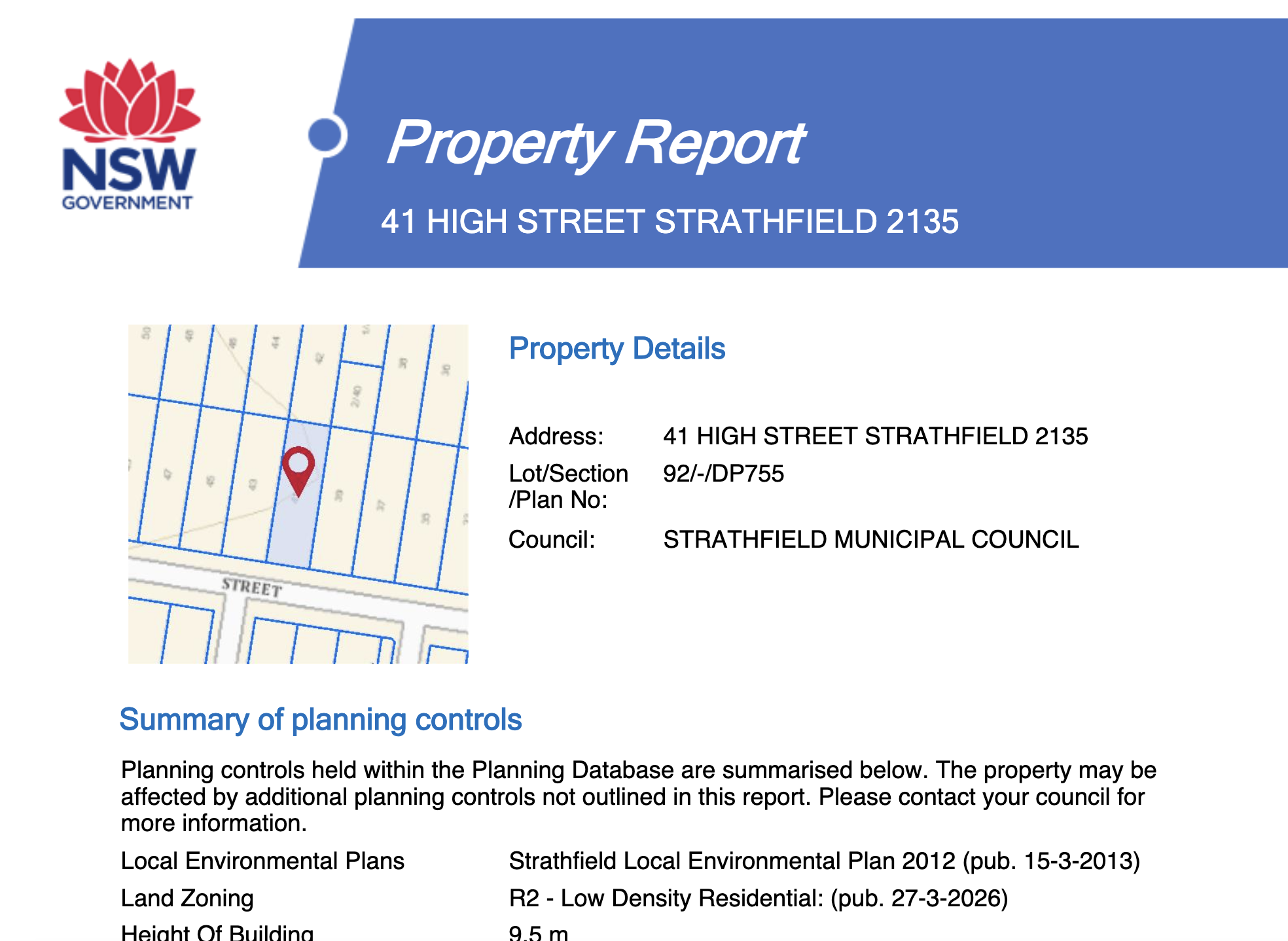
Generate planning reports instantly
We generate state and council property reports directly, so there's no government portal to dig through.
- ✓Official state & council report formats
- ✓NSW, VIC, QLD, ACT & TAS
- ✓Built on request, not just linked
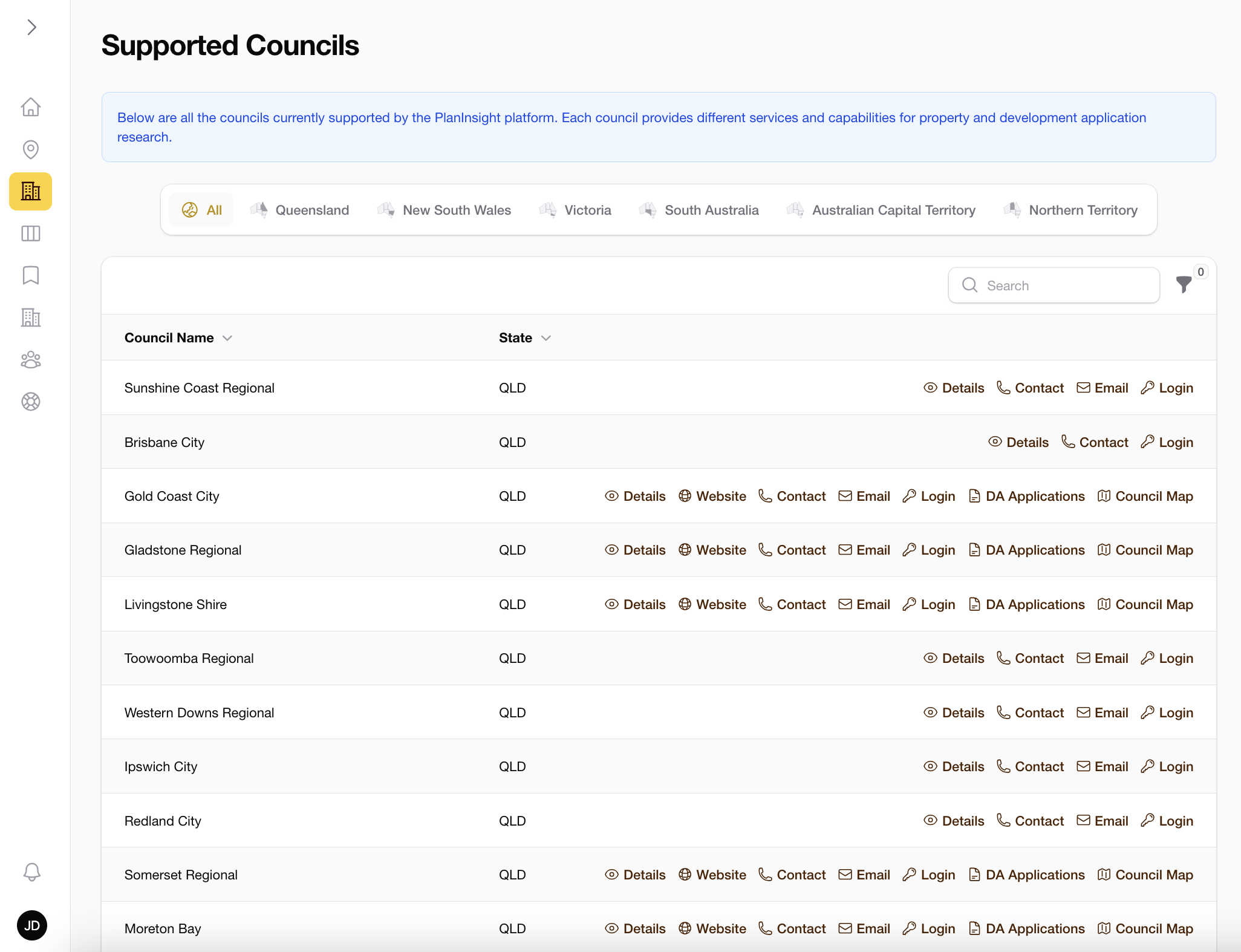
252+ councils, kept current
Every supported council with its DA search, contacts, maps and login portals, maintained so you never juggle government portals again.
- ✓Live DA tracking across QLD, NSW, VIC, SA, ACT, and NT
- ✓Title & cadastre in all 8 regions
- ✓Direct council links, always current
From address to action in three steps.
Look up the property
Search by address, lot/plan, or click a parcel on the map. Works in every state.
See the whole picture
Title, area, planning zone, DAs and council contacts: all on one screen.
Take it further
Download DXF, generate reports, watch DAs, or drop the property on a task board.

Every state. Every council we add.
Title and cadastre across all 8 states and territories. Live DA tracking in QLD, NSW, VIC, SA, ACT, and NT, sourced from each council's own system. Not a national scraper.
Everything else lives here too.
Dial Before You Dig
We submit the BYDA enquiry for you and notify you the moment utility responses land.
Property task board
A Kanban board that lives with the property. Rich comments, drag-and-drop, attachments.
Instant notifications
New DAs, status changes and completed BYDA enquiries: pushed to you, not chased by you.
Title & cadastre
Authoritative parcel boundaries and ownership data across all 8 states and territories.
Land valuations
Current land valuations in QLD, NSW, the ACT and the NT, right next to the title data.
Saved properties
Pin the properties you’re working on and keep their data, DAs and tasks one click away.
Just need one property?
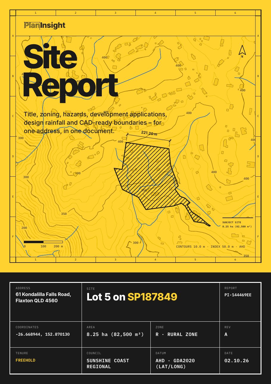
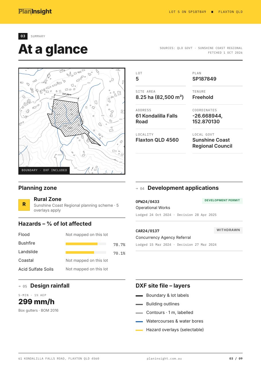
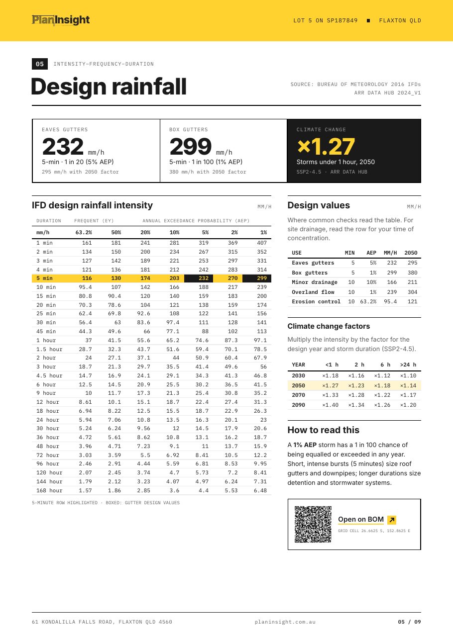
Title, zoning, hazard overlays, development applications, design rainfall, water bores and a CAD-ready DXF for one lot, in one PDF. Every source is dated. $29 once, and it's credited if you subscribe within 14 days.
Plans that scale with your team.
Unlimited lookups and DA tracking across 252+ councils, with Site Reports included. 14-day free trial, no credit card.
Starter
- 10 Site Reports a month
- Unlimited lookups, all 8 states & territories
- DA tracking across 252+ councils
- BYDA underground enquiries lodged for you
- Government planning & survey reports
- DXF property files for AutoCAD & Civil 3D
- Email alerts for new DAs & BYDA responses
Team
Recommended- 100 Site Reports a month
- Team workspace: tasks, clients & progress
- Client records with custom fields
- Comments on properties & tasks
- Task assignment, due dates & overdue reminders
Business
- Unlimited Site Reports
- Priority support, 1‑hour response
- Team onboarding session
Enterprise
- Unlimited Site Reports
- Unlimited users
- Dedicated success manager
- Procurement, invoicing & volume pricing
- Custom integrations & data exports
Just need one lot?
Site Report · $29 one-off · no account
- Zoning, hazard overlays and DA history
- Design rainfall and registered water bores
- DXF: boundary, buildings, contours, watercourses*
- PDF and DXF emailed as one zip
Subscribe within 14 days and the $29 is credited.
* Where the state publishes the data.
Questions, answered.
Stop chasing councils. Start here.
Every property. One place. Look up your first address today and see what the rest of the team's been missing.