A contours DXF for one lot needs the finest contour map the state publishes there, clipped to the site, in metres with elevations intact. Build it from state data in QGIS, or search the address in PlanInsight and download site contours as CONTOUR_MINOR, CONTOUR_MAJOR and CONTOUR_INDEX layers with elevation labels, alongside the boundary.
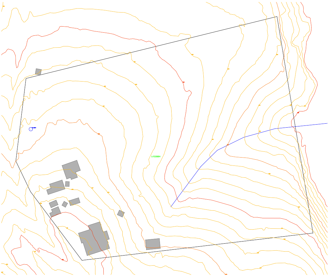
Contour map sources by state
PlanInsight uses the finest source covering the lot.
| State | Sources, in order tried | Finest interval |
|---|---|---|
| QLD | LiDAR 1 m, LiDAR 5 m, SRTM 10 m | 1 m |
| NSW | NSW Spatial Services 10 m, then 20 m | 10 m |
| VIC | LASSI 1 m, Vicmap metro 1 m, Vicmap 10 m, Vicmap 20 m | 1 m |
| WA | SLIP 2 m, then 10 m | 2 m |
| SA | Location SA topographic contours | Varies by area |
| TAS | theLIST 5 m, then 10 m | 5 m |
| ACT | Not available | |
| NT | Not available |
- Contour maps QLD and contour map Victoria: 1 m over most urban areas, enough for concept grading.
- Free contour maps NSW: Spatial Services publishes 10 m and 20 m, so a suburban lot may show one line or none.
- ACT and NT: no contours included.
LiDAR contours download from ELVIS
For finer detail, especially in NSW, ACT and NT, ELVIS LiDAR offers point clouds and DEMs, not contours. Download a DEM, generate contours in QGIS or Civil 3D, clip to the lot, and export to DXF with elevation as a Z value or label. See the Queensland contours guide.
Download contours DXF in PlanInsight
- Type the address into Address under Quick Search and click Look Up Property. For a lot with no address, use Property Lookup and the By Lot / Plan tab.
- Click Download DXF.
- Keep Elevation Contours ticked under Spatial Overlays and Property Boundary under Base.
- Click Download and open the contours in AutoCAD or Civil 3D.
The file is DXF R12 in metres, in local coordinates about the lot centroid, not MGA. No DWG. Contours are clipped to the lot plus a 12 m margin. Every layer is included on every plan, with a 14-day free trial and no card. The free boundary tool gives BOUNDARY and PARCEL_LABEL only, without contours. See the contours DXF page for current sources.
Civil 3D surface from contours
The contours are 2D polylines with elevation labels, so a drawing, not a surface yet.
- Place it. In an MGA drawing,
ALIGNthe DXF on two boundary corners. - Set elevations. Give each polyline the elevation on its label, in Properties or with a text-to-elevation routine.
- Build a TIN surface and add the three contour layers as contour data.
- Add the boundary as an outer boundary so the surface doesn’t triangulate beyond the lot.
How much does a contour survey cost?
It varies by site and surveyor, so get a quote from a registered surveyor. Desktop contours are for concept and feasibility, not survey-grade: a 10 m interval on a small lot is context only. Detailed design and earthworks still need a detail and contour survey. Elevations are generally AHD.