A desktop site feasibility study answers one question before you quote: is there anything about this lot that changes the job? In about ten minutes, a desktop site assessment confirms the lot, gets the boundary and contours into CAD, runs a flood overlay check, reads the zone and searches development applications. Here’s the site analysis checklist, run from one PlanInsight property report.
Site analysis checklist
- Lot and plan search. Confirm lot, plan, area and tenure. Look closer if the address covers more than one lot or the area doesn’t match the brief.
- Boundary. Shape, frontage, depth. Watch for battle-axe lots or boundaries along a creek or road reserve.
- Fall. High and low points, and whether the site drains to the street.
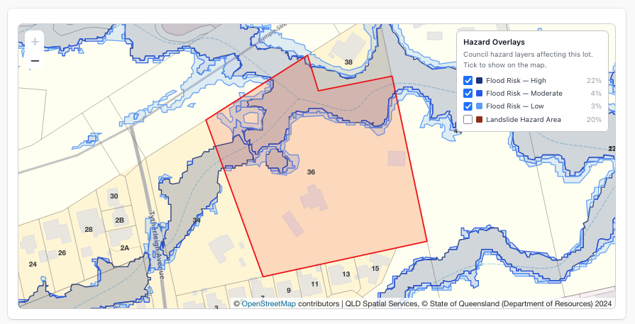
- Hazard overlays. Flood, bushfire, landslide, coastal, acid sulfate soils, and the share of the lot each covers.
- Zone. The planning zone and any minimum lot size.
- DA history. Approvals and their conditions, refusals, live applications.
- Services. A trunk sewer or gas main through the lot changes the layout.
Run the desktop site assessment in PlanInsight
Search. Type the address into Address under Quick Search and click Look Up Property. With only a lot and plan, use Property Lookup and the By Lot / Plan tab.
Confirm the lot. Read Lot Number, Plan Number, Area (m²), Tenure and Surveyed in Property Details.
Get the site into CAD. Click Download DXF. Keep Property Boundary and Parcel Label under Base, and Elevation Contours, Building Outlines and Watercourse under Spatial Overlays, then click Download. The file is DXF R12 in metres, in local coordinates (not MGA), so
ALIGNit onto your base. ACT and NT have no contours.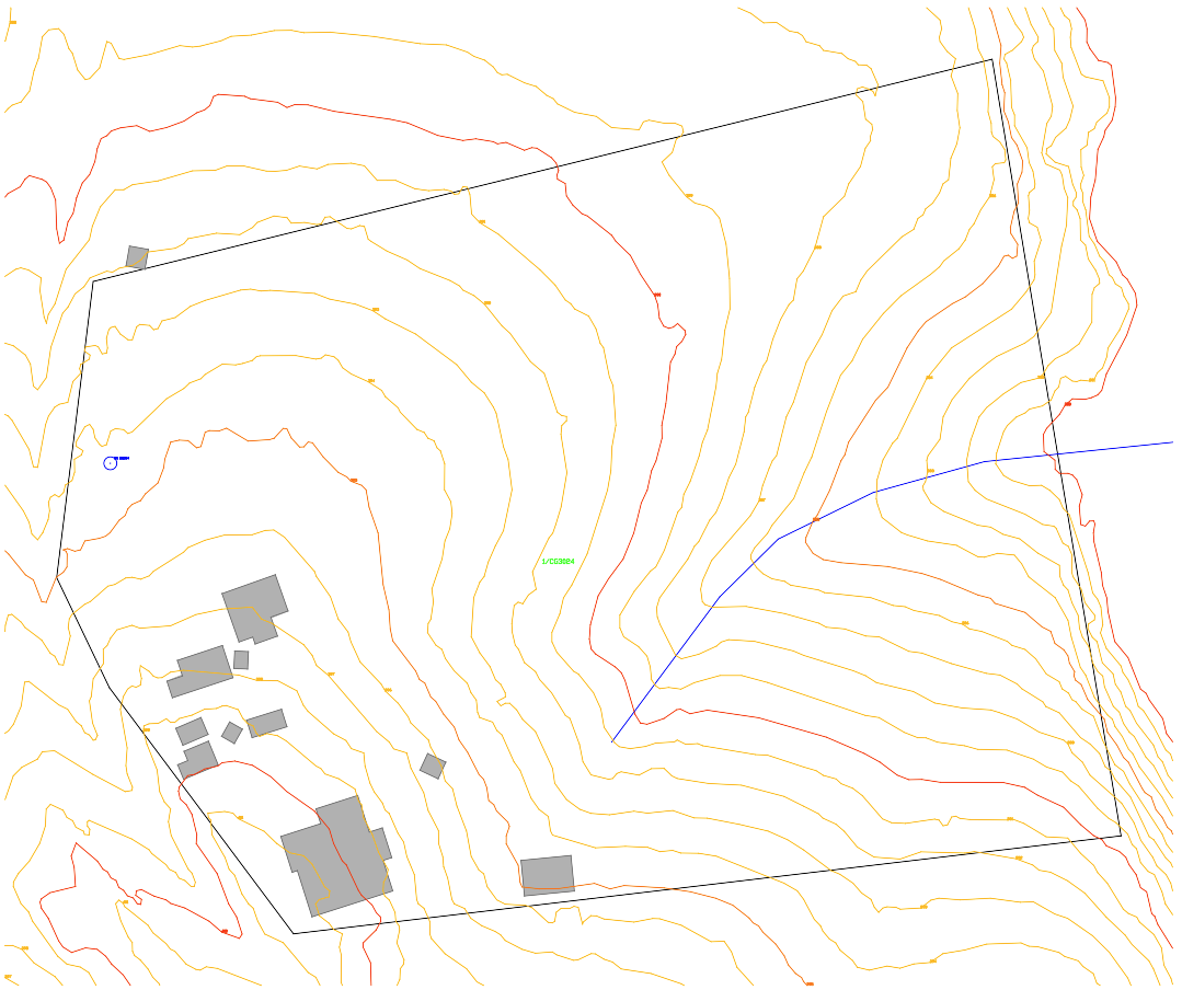
Flood overlay check. The Hazard Overlays section lists each overlay affecting the lot with its share, such as “38% of lot”. The same overlays are in the Hazard Overlays group of the DXF dialog. NT hazard overlays aren’t covered.
Zone. Read the Planning Zone section; Min Lot Size shows in Property Details where available.
Development applications search. The Development Applications section lists the lot’s applications with status, dates and description. Click Watch DAs to hear about new ones.
Services. The Underground Infrastructure section holds BYDA responses for the location.
Every layer and overlay is on every plan, with a 14-day free trial and no card. Just need the lot outline? The free boundary tool gives BOUNDARY and PARCEL_LABEL as a DXF with no account.
What should a due diligence property note include?
For civil engineering feasibility, a short note per site is enough to reach the fee proposal:
- Lot, plan and area confirmed
- Fall and direction
- Overlays affecting the lot, with percentages
- Zone and relevant DA conditions
- Services of concern
- What needs a surveyor, geotech or pre-lodgement meeting
Keep it in Comments on the saved property.
What can’t a desktop check tell you?
Desktop data is mapped, modelled and sometimes out of date. The cadastre isn’t the registered boundary, contours aren’t survey-grade, and overlays aren’t planning certificates. Use it to decide what to quote and investigate; anything lodged, built or set out needs council certificates and a registered surveyor.