If you need the planning zone and overlays for a Victorian property, the Victorian Government already gives you a free Planning Property Report. Use it. It is accurate, it is current, and it costs nothing. This post is about what that report covers, where it stops, and what a site assessment needs on top of it.
Where to get the free Victorian reports
Both free reports come from VicPlan on the Victorian Government’s land and planning site. Search the address, select the property, then generate the report as a PDF. There is no account and no fee.
Victoria publishes two of them for the same property:
- Property Report. Property identifiers (address, lot and plan, Standard Parcel Identifier, local government area), an approximate land area and site dimensions, and an aerial image.
- Planning Property Report. The planning zone and the planning overlays that apply, links to the relevant planning scheme maps and ordinance, the designated bushfire prone area status, and the Aboriginal cultural heritage sensitivity of the land.
For zoning, that second report is the primary source. Victoria’s planning scheme is standardised statewide, so the zone and overlay codes you read there are the same codes a planner, a council officer and VCAT will use. No third party improves on it.
Where the free report stops
The Planning Property Report answers one question: what planning controls apply to this land. It was never meant to answer the rest of a site assessment. In practice these are the gaps people hit:
- No contours or levels. There are no elevation contours and no surface. You cannot see fall across the site, or whether stormwater can get to the street by gravity.
- No design rainfall. No IFD data, so no intensities for gutter, pit, pipe or detention sizing. That comes from the Bureau of Meteorology separately, for the exact site coordinates.
- No development application history. The report does not list what has been lodged, approved or refused on the lot, or on the neighbours. Overlay status tells you a permit is triggered. DA history tells you what the council has actually done with that trigger nearby.
- No registered water bores. Groundwater bores near the site matter for excavation, basements, dewatering and contamination. They are in the national groundwater register, not in a planning report.
- Nothing opens in CAD. The output is a PDF with a map image. To get the boundary into AutoCAD, Civil 3D or QGIS you are tracing a screenshot, or buying the cadastral data another way.
- No land size you can rely on for design. The Property Report’s area is approximate, taken from the cadastral mapping. The area that matters legally is on the title and the registered plan of subdivision.
None of that is a criticism of the free report. It is a planning report and it does the planning part properly. The point is that a desktop site assessment is six or seven sources, and the free report is one of them.
The other sources, and who publishes them
If you want to assemble this yourself in Victoria, these are the tabs:
| What you need | Where it comes from |
|---|---|
| Zone and overlays | VicPlan Planning Property Report |
| Title, lot and plan, area | Landata (title search and plan of subdivision) |
| Contours and surface | ELVIS, or council LiDAR derived contours |
| Flood overlays and flood advice | VicPlan plus the catchment management authority and council |
| Bushfire (BMO and BPA) | VicPlan, plus the CFA for a BAL assessment |
| Design rainfall (IFD) | Bureau of Meteorology 2016 IFD, by coordinates |
| Development applications | The council’s own planning register |
| Registered water bores | Bureau of Meteorology national groundwater register |
| Cadastre for CAD | Vicmap Property, via a data service |
Each one is free to look at. The cost is the hour of tab switching, the risk of reading a stale layer, and the tracing job at the end.
What a $29 Site Report adds in Victoria
The PlanInsight Site Report is a one off report for a single address that collects those sources into one PDF, with a dated source line on every section, plus a DXF of the same lot.
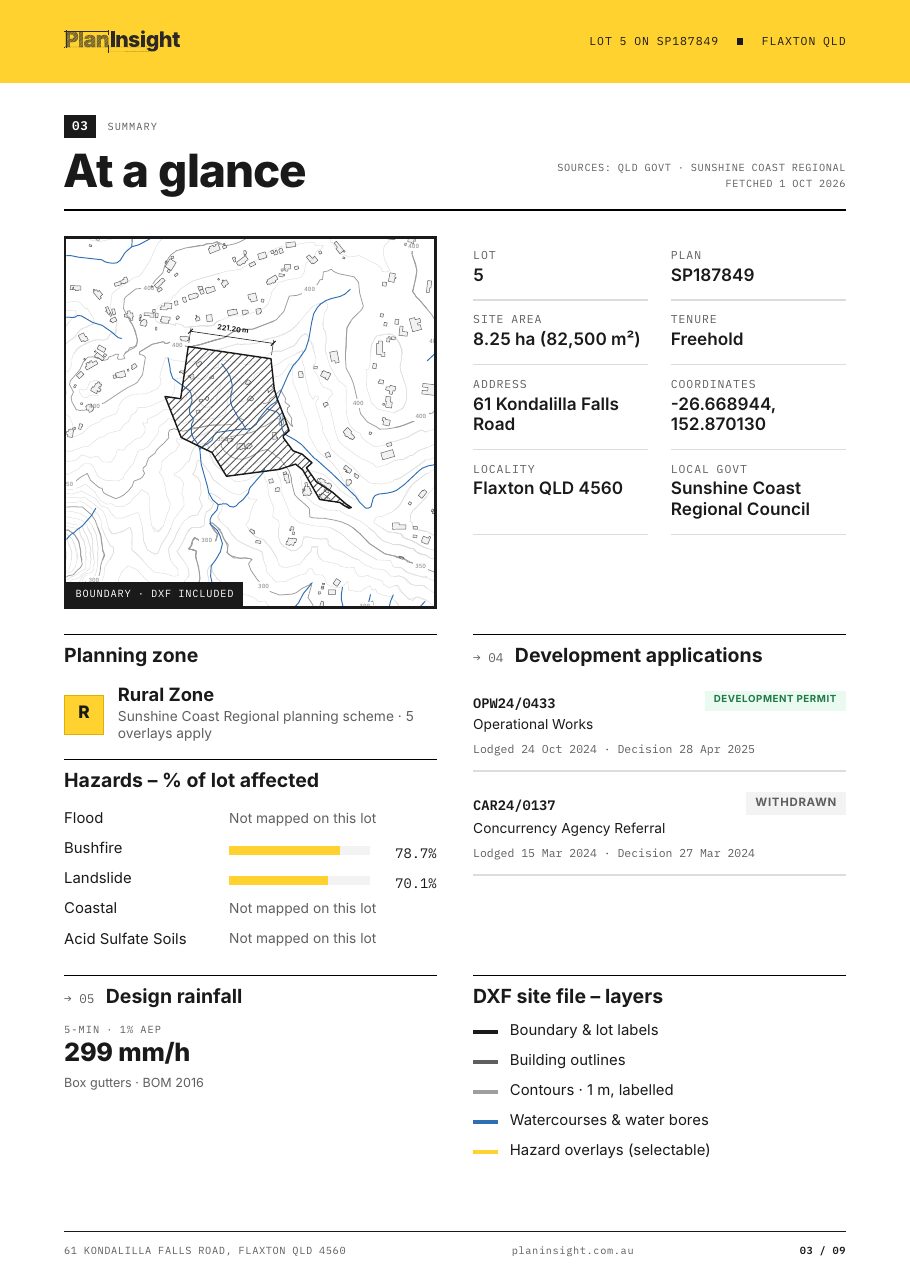
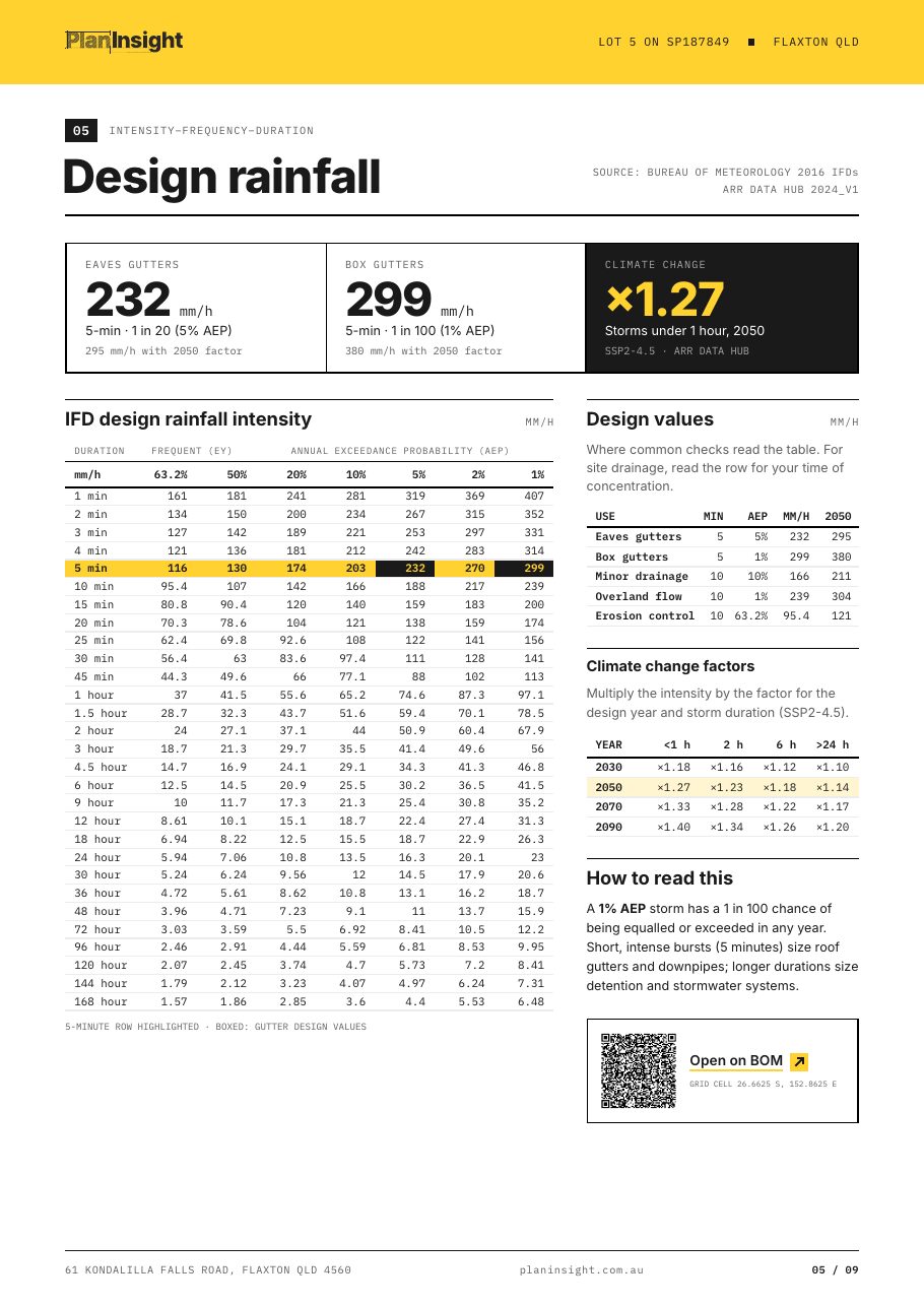
In Victoria it includes the title details (lot, plan, area and tenure), the zone where the council publishes it, the hazard overlays with the share of the lot each one covers, the DA history recorded for the lot, the Bureau of Meteorology 2016 design rainfall table with climate change factors, every registered water bore on the lot and within 500 m of it, and contours.
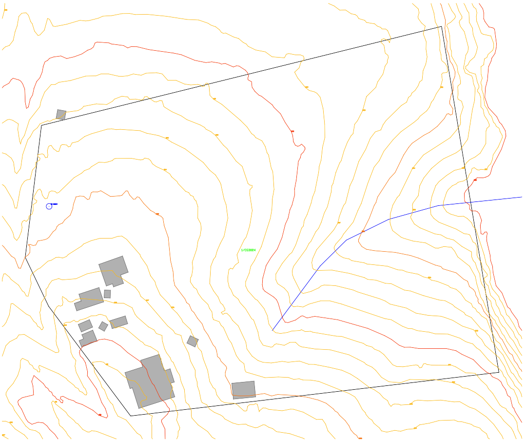
The DXF is R12, drawn in metres, with the boundary and lot label, building outlines, contours with elevation labels, watercourses, water bores and each hazard overlay on its own layer.
To be clear about what it is not. It is a research report compiled from public government and council records. It is not a planning certificate, not a registered survey and not a title search. If you need the registered dealings, easements or covenants on the title, order a title search from Landata. If you need a planning certificate, ask the council. Anything you intend to rely on should be confirmed with the council or a licensed professional.
You confirm the lot on a map before you pay, it is $29 including GST, and if a report fails to generate it is refunded in full. Reports are available in Victoria, Queensland, New South Wales, South Australia, Tasmania and the ACT.
Common Victorian questions
Is there a free planning report for Victoria?
Yes. The Planning Property Report from VicPlan is free, instant and official. Start there for zone and overlays.
How do I do a dwelling entitlement search in Victoria?
There is no register of dwelling entitlements to search, which is why this question has no clean answer online. Whether a rural lot can take a dwelling is worked out from four things: the zone and its schedule in the planning scheme, the lot size against the minimum in that schedule, the title and plan history showing when and how the lot was created, and the council’s own view of any existing use rights. The Planning Property Report gives you the first part. Landata gives you the title and plan. The council’s planning department confirms the rest in writing, and that written confirmation is the only thing worth relying on before you buy.
How do I check land size in Victoria?
The Property Report shows an approximate area from the cadastral mapping, which is fine for a first look. The area that matters is the one on the registered plan of subdivision and the title. Where the two disagree, the plan wins, and only a licensed surveyor can tell you where the boundary actually sits on the ground.
Can I get the Victorian cadastre into AutoCAD?
Not from the free PDF reports. You need the Vicmap Property data, or a DXF export. The free property boundary download gives you the boundary for one lot with no account, and the contours DXF page covers levels.