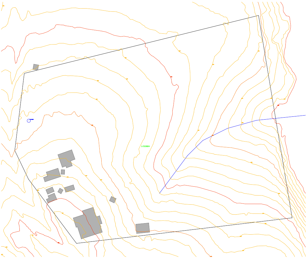
The fastest way to start an AutoCAD site plan is a property boundary DXF: one file with the lot boundary, lot label, buildings, contours, watercourses and hazard overlays, each on its own named layer, in metres. You can build that CAD file of a property by hand from state government data, or search the address in PlanInsight and download it in a couple of minutes.
Cadastral data download: the manual way
- Find the lot in the state viewer: QLD Globe, SIX Maps, VicPlan, Location SA, PlanWA, theLIST or ACTmapi.
- Download cadastre, buildings, contours and hydrography as separate extracts, usually SHP.
- In QGIS, clip to the lot, reproject to metres and export each layer to DXF.
- Look up planning overlays separately and trace them.
The data is good, but it is a GIS job for every site. See the QLD Globe and SIX Maps walkthroughs.
Property boundary DXF download in PlanInsight
Only need the boundary? The free property boundary DXF tool needs no account and gives you the BOUNDARY and PARCEL_LABEL layers.
For the full site base:
- Search. Type the address into Address under Quick Search and click Look Up Property. For a lot and plan search, use Property Lookup → By Lot / Plan, or By Map.
- Confirm the lot. Check Lot Number, Plan Number and Area (m²) in Property Details.
- Click Download DXF at the top of the property page.
- Pick layers. Base holds Property Boundary and Parcel Label. Spatial Overlays holds state layers such as Building Outlines, Watercourse and Elevation Contours. Hazard Overlays appears only when hazards were found on the lot.
- Click Download and open it in AutoCAD, Civil 3D, BricsCAD or QGIS.
Every layer is included on every plan. Start with a 14-day free trial, no credit card.
What the DXF includes
Every state gets boundary, buildings and watercourses. Contours cover every state except the ACT and NT. Flood and bushfire overlays cover every state except the NT, which has no hazard overlays; landslide, acid sulfate and coastal layers vary by state (in NSW, “coastal” means coastal management areas). The property boundary DXF page has the full breakdown.
Layers are fixed, so you can freeze or recolour them: BOUNDARY, PARCEL_LABEL, BUILDING, CONTOUR_MINOR/MAJOR/INDEX with elevation labels, WATERCOURSE, and OVERLAY_* layers with matching _FILL layers. Everything is clipped to the lot plus a small margin.
Placing it on your drawing
- DXF R12, in metres. Not a DWG; save as DWG from AutoCAD if needed.
- Local coordinates, not MGA. The lot sits near 0,0. To combine with a survey,
MOVEa boundary corner onto the surveyed corner, orALIGNwith two. - Xref it so you can refresh site data without touching design layers.
This is concept data, not survey-grade. The cadastre can be out by metres in rural areas, and easements are not included. Anything lodged or set out needs a registered surveyor.
How do I find property boundaries in QLD?
Run a lot and plan search in QLD Globe or PlanInsight’s By Lot / Plan tab. For the registered plan, see how to download a QLD survey plan.
Where are property boundary maps for NSW and property boundaries in Victoria?
NSW has SIX Maps; Victoria has VicPlan. Neither gives you a layered site DXF in one step, so search the address in PlanInsight instead.