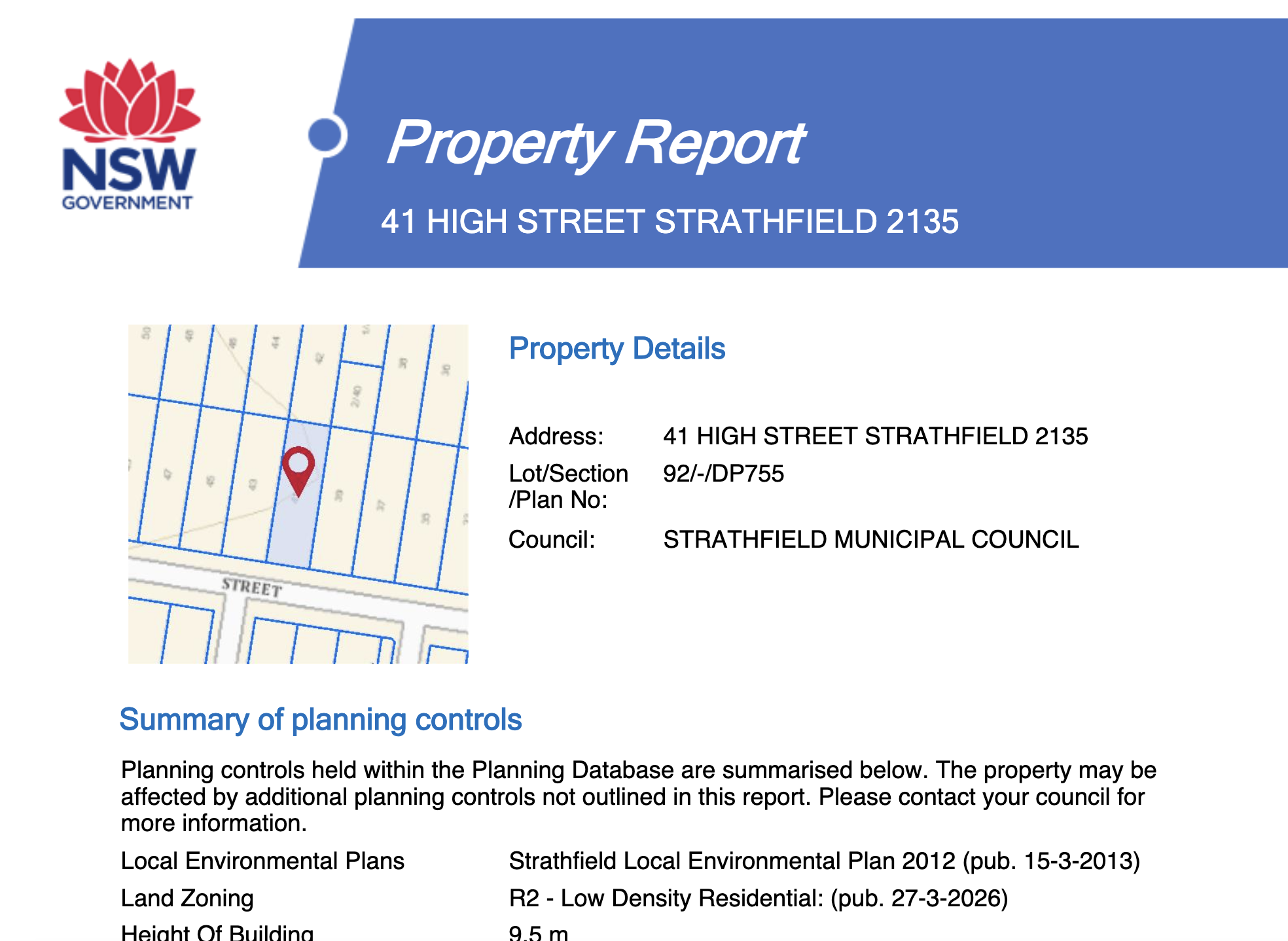
A DP number is a Deposited Plan number. It is the registration number of a survey plan lodged with New South Wales Land Registry Services, and it is how a parcel of land is identified in that state. You will almost always see it paired with a lot number, written as “Lot 12 DP 1234567”.
What the two parts mean
- The plan (DP 1234567). One registered survey plan. It covers a subdivision, a consolidation or a single parcel, and it shows the boundary dimensions, bearings, areas, easements and any restrictions created by that plan.
- The lot (Lot 12). One parcel within that plan. Lot numbers restart with every plan, so a lot number on its own is meaningless. Lot 12 only identifies land once you say which plan it belongs to.
That pairing is the legal description of the land. The street address is a postal convenience and can change; the lot and plan does not.
DP and SP are not the same thing
In New South Wales you will meet two prefixes constantly:
- DP, Deposited Plan. Ordinary land, including houses, vacant lots and most commercial parcels.
- SP, Strata Plan. A strata scheme. An apartment is “Lot 7 SP 12345”, where lot 7 is the unit, not a piece of ground. The land under the whole building is a separate DP parcel owned by the owners corporation.
If you are buying a unit and someone gives you a DP, they have given you the building’s land parcel, not your lot. Both are useful and they answer different questions.
Older plans use other prefixes you may still see on titles: CP for a County Plan, and Portion or Section references in old parish based descriptions. Anything registered in recent decades will be a DP or an SP.
Where to find the DP number for a property
In rough order of how fast it is:
- The council rates notice. The lot and plan is printed on it.
- The certificate of title or the contract of sale. The legal description sits on the first page.
- SIX Maps. Click the parcel and the lot and plan appears in the identify panel. This is the usual free answer, and it works without an account. See exporting NSW cadastre and contours from SIX Maps.
- The NSW Planning Portal spatial viewer. Search the address, and the property report panel lists the lot and plan with the zone.
To get the plan itself, the drawing with the bearings and distances, you order it from NSW Land Registry Services through an information broker. The plan is what a surveyor works from, and it is the only place the registered boundary dimensions appear.
The same identifier in other states
Every state has the same idea with different punctuation. If you work across borders this table saves a lot of confusion.
| State | Format | Example |
|---|---|---|
| NSW | Lot and Deposited Plan or Strata Plan | Lot 12 DP 1234567 |
| QLD | Lot on Plan, with RP, SP, CP, GTP and others | Lot 5 RP123456, written 5RP123456 |
| VIC | Lot and Plan of Subdivision or Lodged Plan, plus the SPI | Lot 3 PS412345, SPI 3\PS412345 |
| SA | Allotment and plan, plus the title reference | Allotment 42 D12345 |
| TAS | Property ID and lot on plan | Lot 1 Plan 123456 |
| ACT | Block and Section in a Division | Block 14 Section 7 Braddon |
| WA | Lot and Deposited Plan or Diagram | Lot 100 DP 54321 |
| NT | Lot and Town or Hundred | Lot 5678 Town of Darwin |
Queensland’s lot on plan is the one that trips people up, because it is conventionally written with no space and the plan prefix tells you the plan type. There is more on it in downloading a QLD survey plan by lot on plan.
Using the DP number as a land size checker
This is the real reason most people look up a DP number, so it is worth being precise about which area is which.
- The area on the registered plan. The surveyed area for that lot, from the plan that created it. This is the authoritative figure.
- The area on the title. Usually matches the plan.
- The area in the cadastral mapping. Calculated from the digital parcel polygon. Close, but it is a mapping product, so it can differ from the plan by a small margin, and by more on old or irregular parcels.
- The area in a real estate listing. Not a source. It is often the mapping figure rounded, and sometimes it is simply wrong.
So the honest answer to “how do I check land size” is: read the registered plan for the lot, and treat anything calculated from a map as approximate. A free online land size checker is reading the cadastral polygon, and it will tell you so if it is honest.
Two more cautions. Area is not the same as developable area, once you take off easements, overlays and setbacks. And the mapped boundary is not the boundary on the ground: only a licensed surveyor locating the corners can tell you that, and the difference is routinely tens of centimetres and occasionally much more.
From the lot and plan to a usable site file
Once you have the lot and plan, everything else about the site is searchable with it: the title, the survey plan, the zone, the hazard overlays, the DA history and the levels.
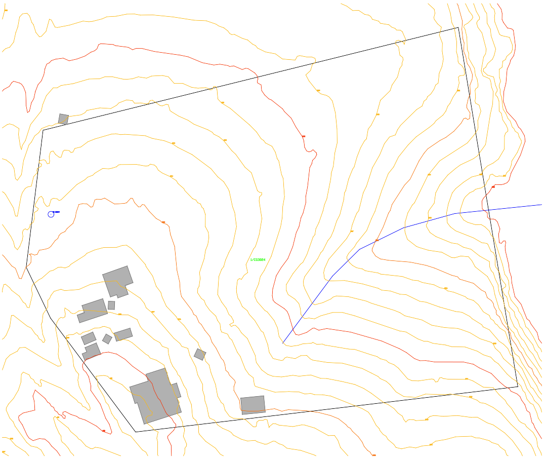
If you want the boundary alone, the free property boundary download takes an address or a lot and plan and gives you a DXF, with no account.
If you want the rest of it in one go, the PlanInsight Site Report is a $29 one off report for a single address: title details (lot, plan, area and tenure), zoning where the council publishes it, flood, bushfire and landslide overlays with the share of the lot each covers, DA history for the lot, Bureau of Meteorology 2016 design rainfall, registered water bores within 500 m, contours, land valuation in Queensland and New South Wales, plus a DXF R12 in metres. You search the address, confirm the lot on a map, then pay. It is available in Queensland, New South Wales, Victoria, South Australia, Tasmania and the ACT, not Western Australia or the Northern Territory.
It is a research report compiled from public records. It is not a title search, so it does not include the registered dealings, easements or covenants, and it is not a planning certificate or a survey. For the easements, order a title search from NSW Land Registry Services.