Port Stephens development applications & site reports

Check any lot in Port Stephens: zoning, overlays, DA history and a CAD-ready boundary in a $29 Site Report.

Council
Port Stephens
State
NSW
DA feed
LiveNSW Planning Portal
Last fetched

Site Report · $29

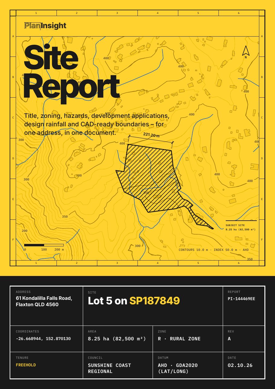
One lot in Port Stephens, in one PDF.

  • Title details: lot and plan, land area and tenure
  • Zoning, where the council publishes it
  • Flood, bushfire and other hazard overlays, where mapped
  • Development application history for the lot
  • Contours and elevation
  • Land valuation
  • A CAD-ready DXF: property boundary, building outlines, watercourses, water bodies, water bores, elevation contours and easements (indicative)

One-off, no account. Emailed as a zip with the PDF and DXF.
Data for Port Stephens

What a Site Report covers here

Coverage depends on what New South Wales and the council publish. Where a layer isn't published, the report says so.

Title details
Lot, plan, area, tenure
Planning zone
Where the council publishes it
Hazard overlays
Flood, bushfire, landslide, acid sulfate soils, coastal
Contours
Down to 10 m
DA history
With council links
Land valuation
Included
Design rainfall (BOM 2016 IFD)
Included
Registered water bores
On the lot and within 500 m
CAD-ready DXF
property boundary, building outlines, watercourses, water bodies, water bores, elevation contours, easements (indicative)
How do I track development applications in Port Stephens?

You can search applications one at a time on Port Stephens's own DA portal, but it won't tell you when something changes. PlanInsight monitors every development application lodged in Port Stephens and alerts you when new applications appear or, where the council publishes it, an application's status changes, alongside property titles, lot and plan details, and planning data for the same property.

Can I get a Site Report for an address in Port Stephens?

Yes. The PlanInsight Site Report covers one lot in Port Stephens for a one-off $29: title details, zoning where the council publishes it, hazard overlays where mapped, the lot's development application history and a CAD-ready DXF with the property boundary, building outlines, watercourses, water bodies, water bores, elevation contours and easements (indicative). It is emailed as a zip and each section states its source and the date it was fetched. It is a research report, not a planning certificate or a survey.

How often is Port Stephens DA data updated?

PlanInsight fetches DA data for Port Stephens directly from the council's published records, and tracked properties are re-checked for changes. Every property view shows when its data was last fetched, so you always know how fresh it is. You're seeing what Port Stephens has published, not a stale copy.

Can I be notified when a DA is lodged at an address in Port Stephens?

Yes, on a PlanInsight plan. Bookmark a property in Port Stephens and you are notified when a new development application is lodged on it or, where the council publishes status, a tracked application changes. Every plan starts with a free trial.