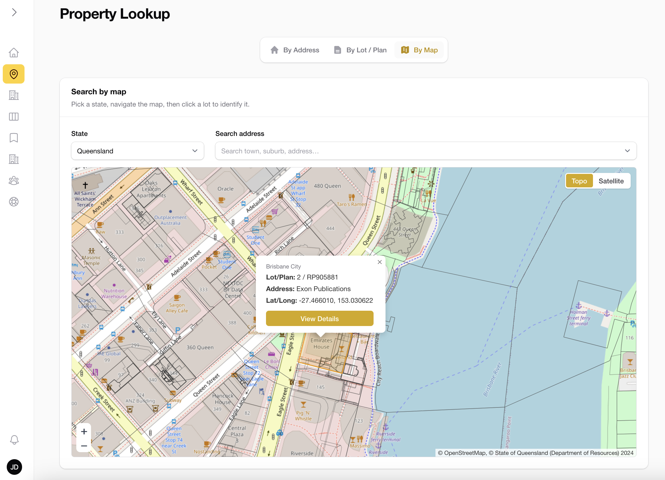
Search any property, three ways
Start from an address, a lot/plan, or click straight on the map. The right parcel resolves in seconds, anywhere in the country.
- ✓Address, lot/plan or map-pin search
- ✓Topographic & satellite base layers
- ✓Interactive boundary map on every lot
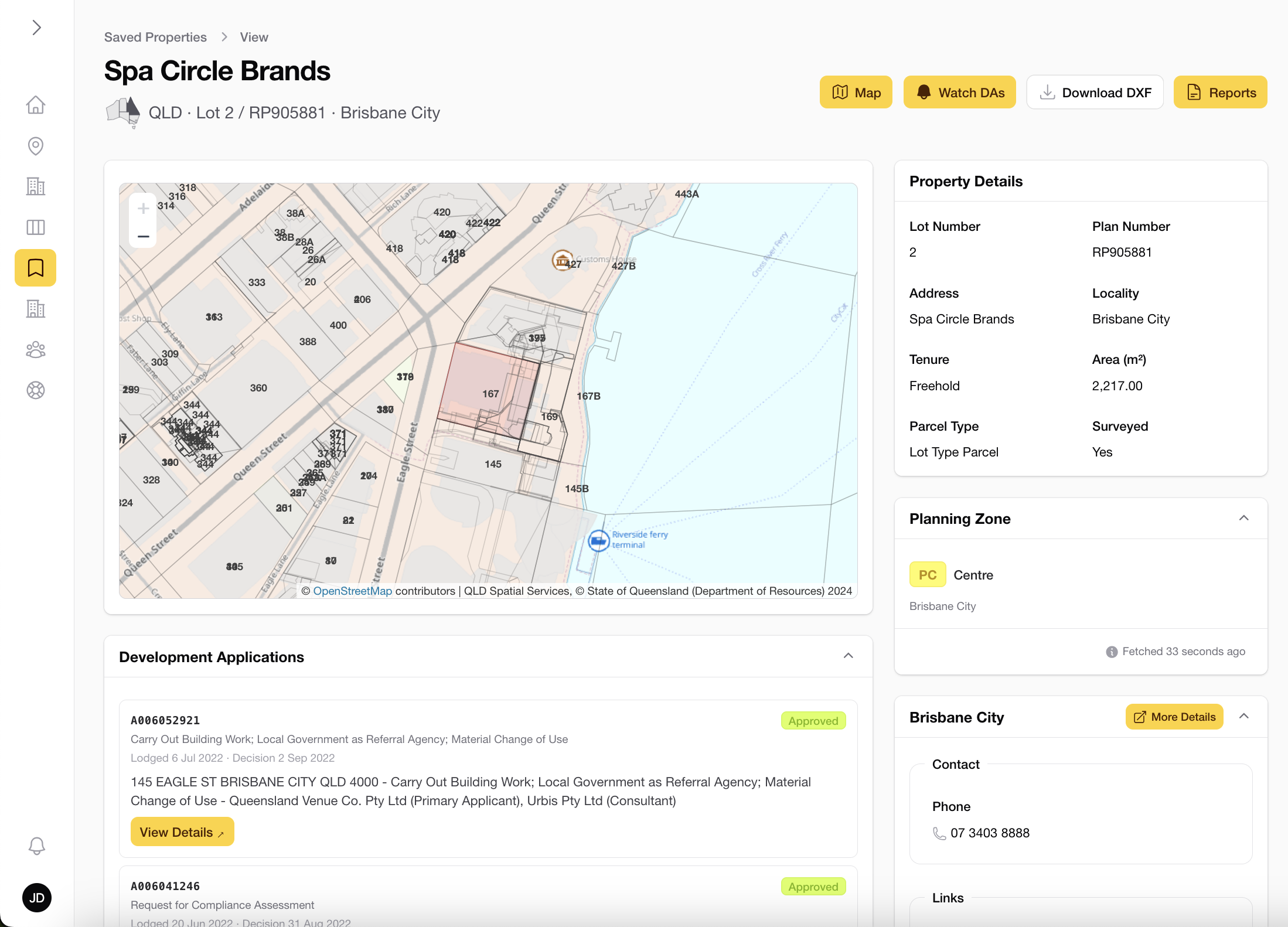
Title and zoning on one screen
Lot and plan numbers, land area, tenure, parcel type and the live planning zone, retrieved the moment you open a property, across all 8 states and territories.
- ✓QLD, NSW, VIC, TAS, SA, ACT, WA & NT
- ✓Lot/plan, area, tenure & parcel type
- ✓Live planning zone with overlay codes
Development Applications, live
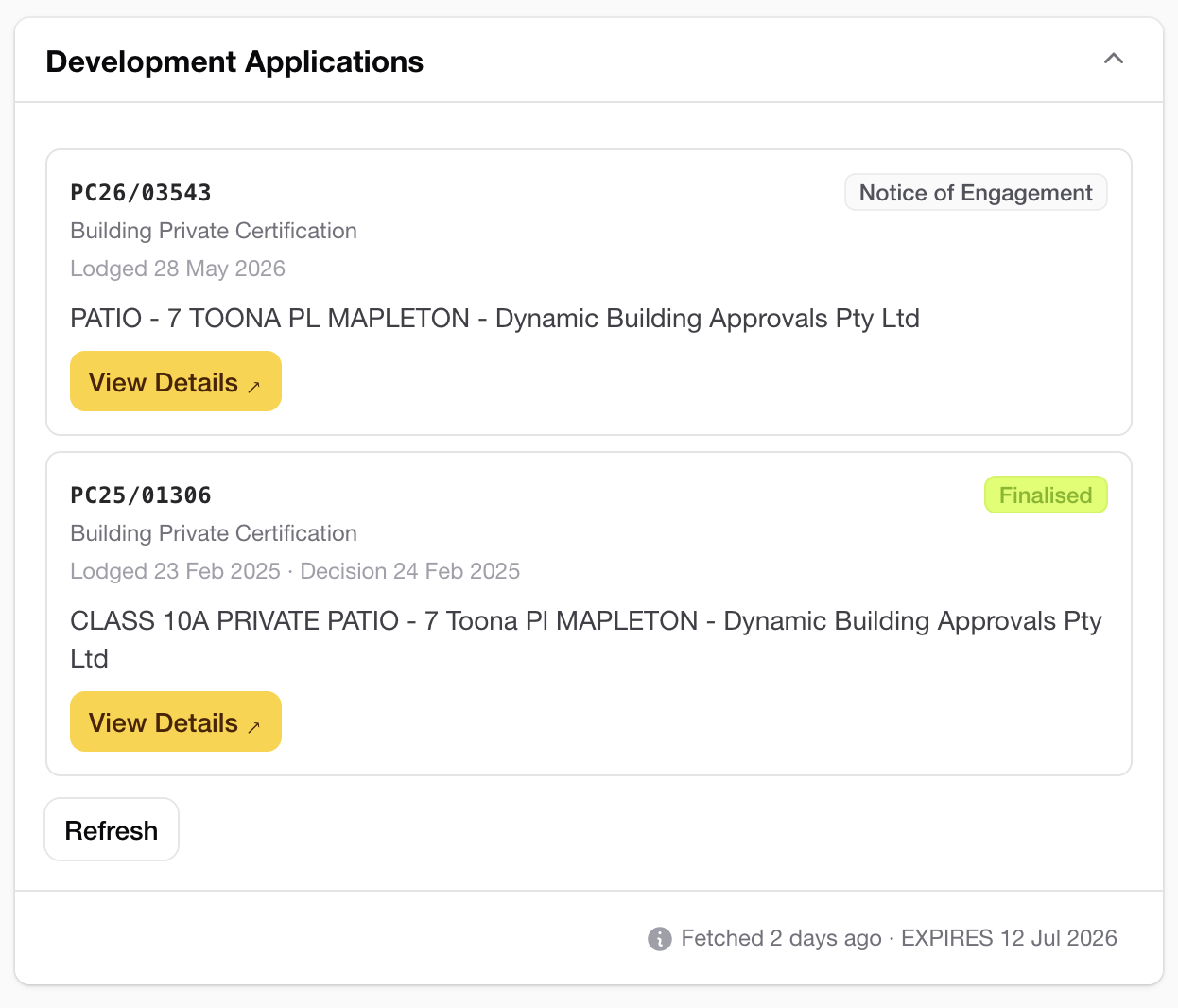
Active and historical DAs across 252+ councils, fetched directly from each council's own system at lookup time. Not a national scraper.
- ✓Active and historical applications
- ✓Status from Lodged to Finalised
- ✓Sourced directly from each council
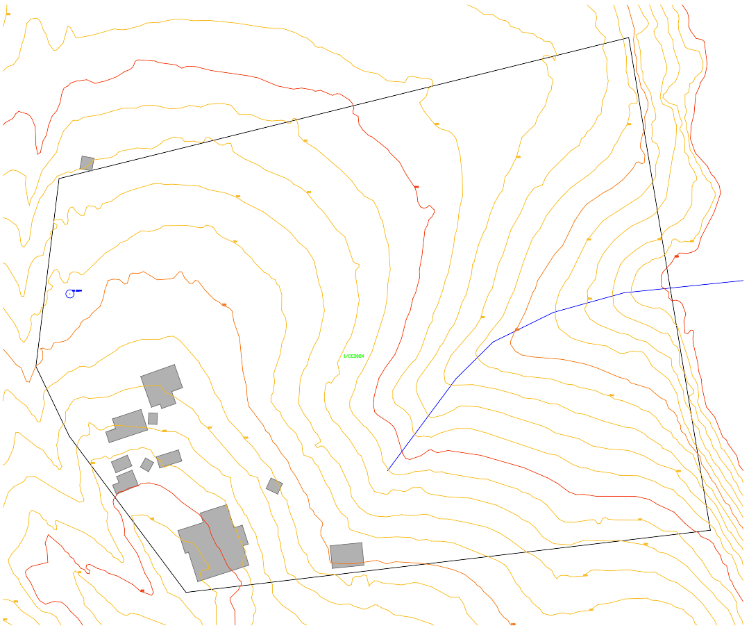
A complete CAD file, in one click
Boundary, buildings, contour lines labelled with elevations and watercourses in every state, plus water bores, water bodies and pathways where the state publishes them. Exported as a layered DXF, ready for AutoCAD, Civil 3D or any CAD package. No re-tracing.
- ✓Layered, true DXF format
- ✓Contours with elevation labels
- ✓Included on every plan
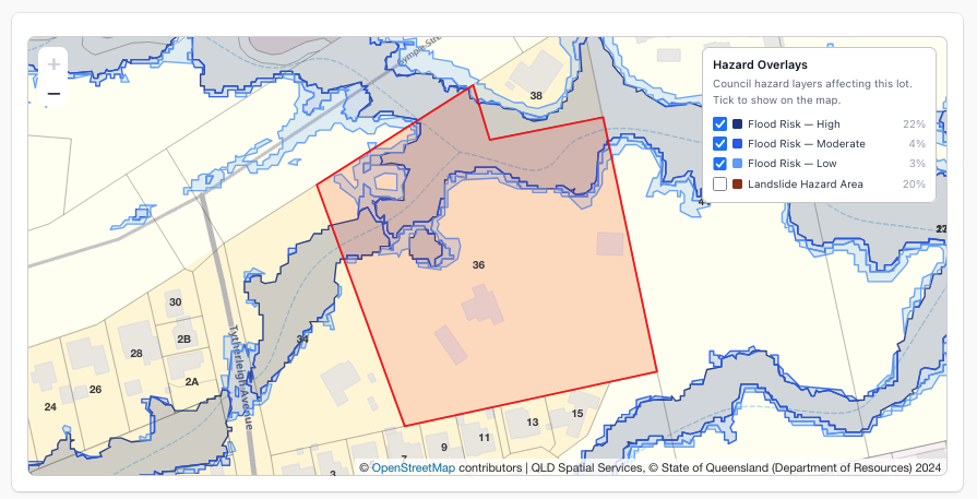
Flood and bushfire, answered on the page
Whether a lot is flood, bushfire, landslide or coastal affected, and how much of it is, without opening a council mapping portal. State planning layers everywhere, replaced by the council's own flood study wherever one is published.
- ✓Affected or not, with percentage of the lot
- ✓Toggle any layer on the property map
- ✓Exported as selectable DXF layers
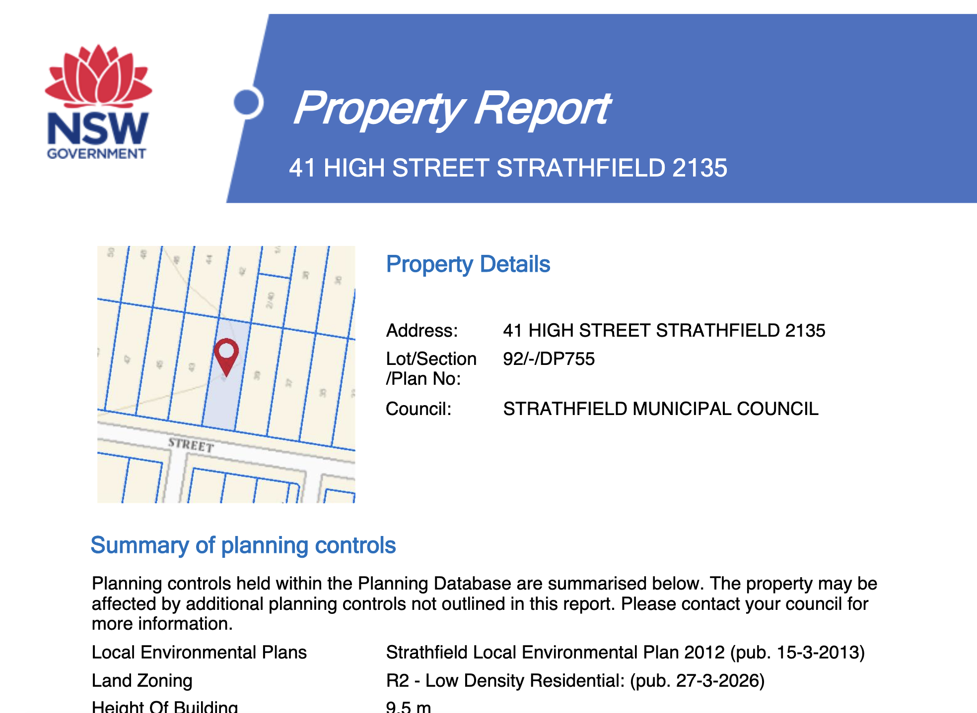
Official planning reports, one click
NSW Property, VIC Planning and Property, ACT Block Dimension and Detail, QLD Survey Plan and the TAS Planning Report. We send the request to the state's own system with the identifier already stored against the property, and hand back the finished report.
- ✓NSW, VIC, QLD, ACT & TAS formats
- ✓Built on request, no portal logins
- ✓No reference numbers to look up

Detailed council info right at your fingertips
Phone, email, website, services portal, DA search and maps for every supported council, kept current so you stop hunting through government sites.
- ✓Contacts, portals & DA search links
- ✓Council & flood maps linked per LGA
- ✓Maintained as councils change
Land valuations, on the property
Current land value, valuation date and year-on-year change, sitting right next to the title data. Live in QLD, NSW, the ACT and the NT.
- ✓Land value & valuation date
- ✓Year-on-year change
- ✓Live in QLD, NSW, ACT and NT

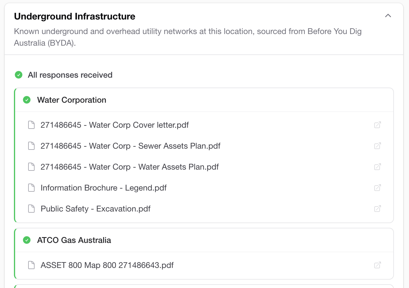
Before You Dig, without the paperwork
Submit a Before You Dig enquiry straight from any property. We lodge it for you and collect every utility response as it lands, so the plans are waiting when you open the property.
- ✓Automated BYDA submission
- ✓Every utility response in one place
- ✓Download response PDFs from the property

Support that lives inside the app
Raise a ticket from anywhere in PlanInsight and follow it through to resolution, or browse the FAQ, start a live chat and email the team without leaving your work. No separate help desk, no lost email threads.
- ✓Raise & track tickets in-app
- ✓FAQ, live chat & email in one place
- ✓Status from Open to Resolved, always visible

The rest of the workflow, in the same place.
Notifications
New DA lodged, status changed, or BYDA enquiry complete, delivered in-app for every property you bookmark.
Task board
A 5-stage Kanban built in. Priority, assignee and property-linked tasks. Team plans and above.
Saved properties
Bookmark properties to a shared workspace. Everyone on the team sees the same list, instantly.
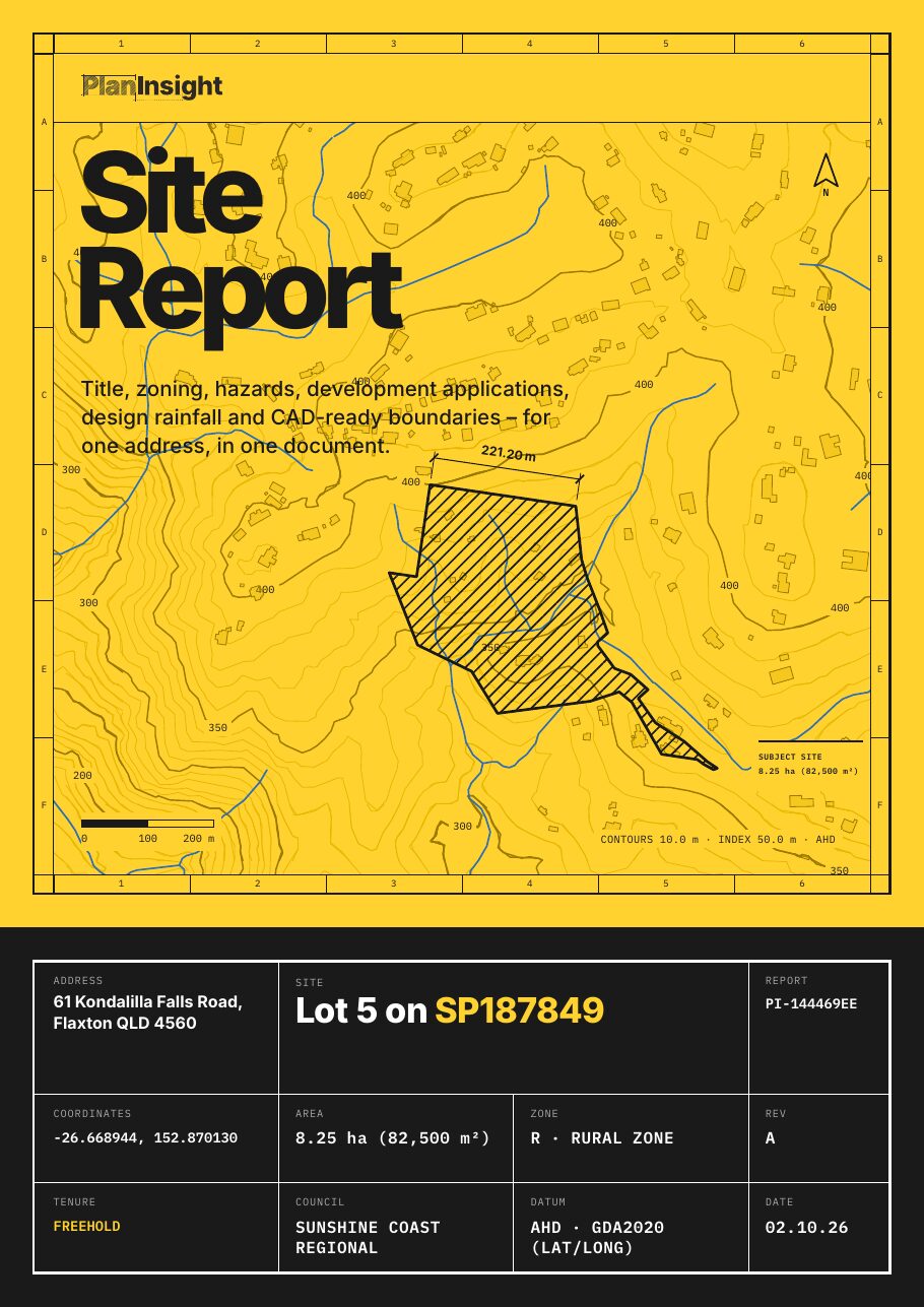
Site Report · $29
Just need one site? Get a Site Report.
- Title details: lot and plan, land area and tenure
- Zoning, where the council publishes it
- Flood, bushfire and other hazard overlays, where mapped
- Development application history for the lot
- Contours and elevation
- Land valuation (Queensland and New South Wales properties)
- A CAD-ready DXF: property boundary, building outlines, elevation contours, watercourses and water bores, where the state publishes them
One-off, no account. Emailed as a zip with the PDF and DXF.
Ready to get started? Look up a property.
Every property. One place. Try your first address today and see the whole workflow in one window.
Comments & collaboration
A rich-text thread on every property and task. Notes, decisions and context, shared with your team in real time.