CAD-ready property files
Type an address and download the boundary with buildings, contours, watercourses and hazard overlays on their own layers. Open it in AutoCAD or Civil 3D and start drawing, not tracing.
14-day free trial · No credit card · Every layer on every plan
One file per lot, clipped to the boundary plus a small margin. Every dataset sits on a named layer, so you can freeze, recolour or delete what you don't need.
BOUNDARYThe cadastral boundary as a closed polyline, from the state's official cadastre. Free for any address, no account.
PARCEL_LABELThe lot identifier as text at the parcel, so you always know which lot you're looking at.
BUILDINGExisting structures on and around the lot, as outlines and a separate fill layer.
CONTOUR_MINOR / MAJOR / INDEXState LiDAR where it exists, as fine as 1 m, with elevation labels. See the contours page for sources.
WATERCOURSEMapped creeks and drainage lines, plus registered bores where the state publishes them.
OVERLAY_*Flood, bushfire, landslide, coastal and acid sulfate layers, included only where they cross the lot.
Download a sample DXF → the file pictured above, all layers
Boundaries work for every address in Australia. The rest depends on what each state publishes.
| State | Contours | Hazard overlays | Other layers |
|---|---|---|---|
| Queensland | 1 m, 5 m, 10 m | Flood, Bushfire, Coastal, Landslide, Steep land, Acid sulfate soils (some councils) | Building Outlines, Watercourse, Water Bores |
| New South Wales | 10 m, 20 m | Flood, Bushfire, Landslide, Acid Sulfate Soils, Coastal management | Building Outlines, Watercourse, Water Bodies, Water Bores |
| Victoria | 1 m, 10 m, 20 m | Flood, Bushfire, Landslide | Building Outlines, Watercourse, Water Bores |
| South Australia | State topographic | Flood, Bushfire, Acid Sulfate Soils, Coastal | Building Outlines, Watercourse, Water Bores |
| Western Australia | 2 m, 10 m | Flood, Bushfire, Acid Sulfate Soils | Building Outlines, Watercourse, Water Bores |
| Tasmania | 5 m, 10 m | Flood, Bushfire, Landslide, Coastal | Building Outlines, Watercourse, Pathways & Tracks |
| Australian Capital Territory | Not yet | Flood, Bushfire | Building Outlines, Watercourse |
| Northern Territory | Not yet | Not published | Building Outlines, Water Bores, Watercourse |
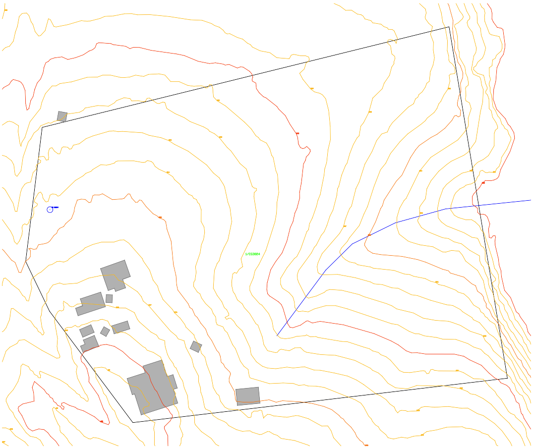
Contours use the finest source available at the lot first. Council flood studies replace the statewide layer where the council publishes one.
Opens in AutoCAD, Civil 3D, BricsCAD, QGIS and most CAD software. Lengths and areas measure true.
Drawn about the lot centroid, not MGA. MOVE or ALIGN it onto your survey or georeferenced base.
Not survey-grade. Anything you lodge, build or set out still needs a registered surveyor.
Yes. The free boundary tool gives you the lot boundary and lot label as a DXF for any Australian address, with no account. Buildings, contours, watercourses and overlays come with a PlanInsight plan, which you can try free for 14 days.
Boundaries work in every state and territory. Contours and hazard overlays depend on what each state publishes. The table above shows exactly what you get in each state.
Yes. It's a standard DXF R12 file in metres, which AutoCAD, Civil 3D, BricsCAD and QGIS all open directly.
No. The drawing uses local coordinates about the lot centroid so everything lines up at lot scale. Place it onto your survey or MGA base with MOVE or ALIGN.
14-day free trial, no credit card. Plans from $49/mo after that.