Property site report for any Australian address.

Zoning, hazard overlays, development applications, design rainfall and a CAD-ready DXF for one lot. Find it, check it on the map, then pay.

  • $29 incl. GST
  • One-off
  • No account
  1. 1 · Find
  2. 2 · Confirm
  3. 3 · Pay $29
Delivered By email, as one zip
Sources Dated on every section
Files PDF and layered DXF
Before you pay Check the lot on a map

What's in the report

A zoning and overlay report, plus the site in CAD.

Title, zone, hazards, development applications, design rainfall and council contacts for one lot. Sections without published data say so instead of being left out, so you know what was checked.

Download the sample (PDF)
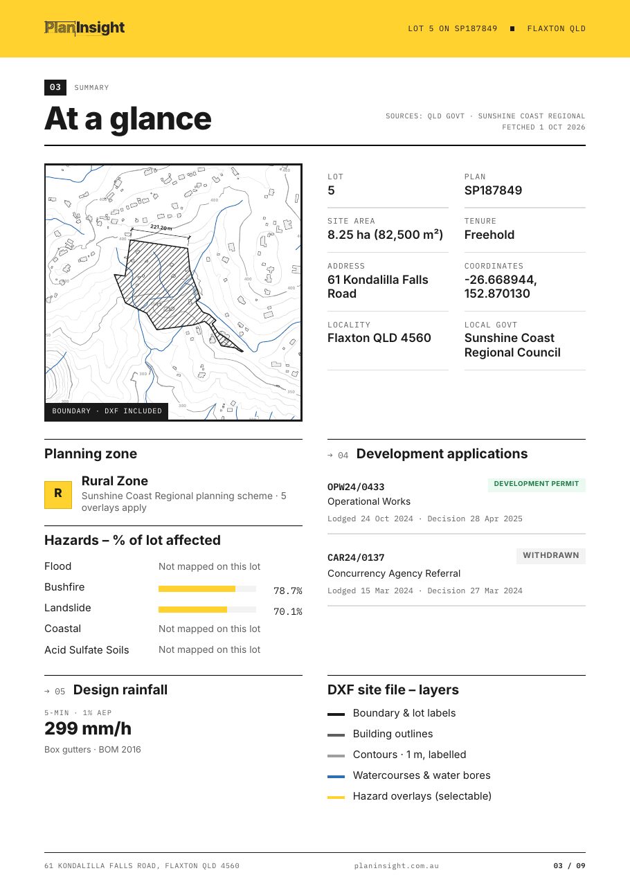
At a glance page of a sample Site Report
At a glance
Lot, title, zone, hazards and recent DAs on one page.
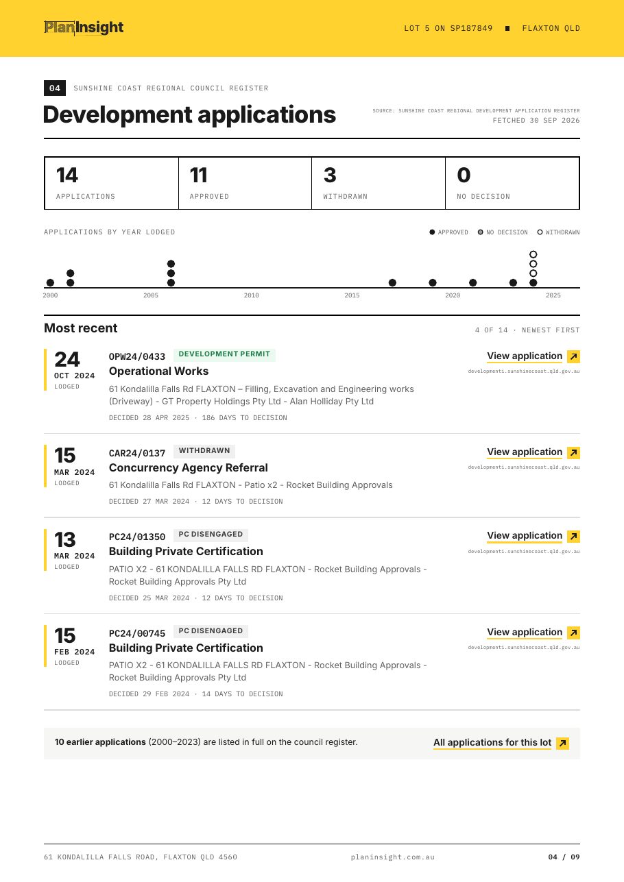
Development applications page of a sample Site Report
Development applications
Every DA on the lot, linked to the council record.
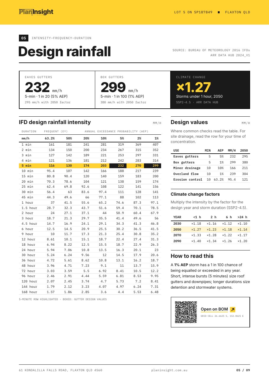
Design rainfall page of a sample Site Report
Design rainfall
The BOM 2016 IFD table, design values and climate factors to 2090.
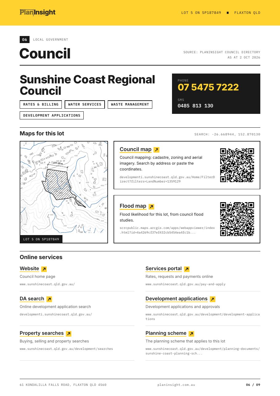
Council page of a sample Site Report
Council
Contacts, maps for this lot and online services.

Included · DXF

The same lot, ready to draw on.

Property boundary, building outlines, elevation contours, watercourses and water bores*, each on its own layer. Opens in AutoCAD, Civil 3D, BricsCAD and QGIS, drawn in metres, north up.

* Where the state publishes the data.

  • Boundary and lot label
  • Building outlines
  • Contours with elevation labels
  • Watercourses and water bores
  • Hazard overlays, each on its own layer

What $29 saves you

Seven tabs and a trace job, done for you.

Each of these is free to look at. Pulling them together for one lot, checking the dates and drawing the site is the hour the report saves.

  1. State titles and cadastre map
  2. Council planning scheme and overlays
  3. Flood, bushfire and landslide maps
  4. Council DA portal
  5. BOM design rainfall
  6. Survey plan and council records
  7. Tracing the boundary, buildings, contours and watercourses into CADDXF
252+
councils with live DA feeds
6
states and territories you can order in
$29
one-off, PDF and DXF

Who buys it

Due diligence on one lot, done once.

Pricing

One lot, or every lot.

Free tools

$0

Boundary DXF for any address and a 12d to DXF converter. No account.

Get a free boundary DXF
One property

Site Report

$29once, incl. GST

  • PDF report and layered DXF
  • No account, no subscription
  • Full refund if it fails to generate
  • $29 credited if you subscribe within 14 days
Get the report

Plans

from$49/mo

Unlimited lookups, Site Reports included, live DA tracking across 252+ councils, BYDA enquiries and full DXF files for your team.

Start free trial

FAQ

Site Report questions

Still unsure? Look through the sample report first, or get in touch.

Is this a planning certificate or a survey?

No. It is a research report compiled from public government and council records. It does not replace a council planning certificate (a section 10.7 certificate in NSW, for example), a registered survey, a title search or professional advice. Check anything you plan to rely on with the council or a licensed professional.

How current is the data?

Each section states its source and the date its data was fetched, so you can see exactly how current it is. Government and council sources update on their own schedules, which is why the dates are printed rather than hidden.

What if the report fails to generate?

If a report fails to generate, we refund it in full. You confirm the lot on a map before you pay, and a delivered report is final.

What is in the DXF?

A DXF R12 file drawn in metres with the lot boundary and label, plus the building outlines, elevation contours, watercourses, water bores and hazard overlay layers your state publishes for that lot. It opens in AutoCAD, Civil 3D, BricsCAD, QGIS and most other CAD software.

Which states can I order in?

Queensland, New South Wales, Victoria, South Australia, Tasmania and the ACT. Reports are not available in Western Australia or the Northern Territory yet. Zoning is included where the council publishes it, and land valuations for Queensland properties.

Does the report show easements?

The report covers title details (lot, plan, area and tenure) but not the registered dealings on the title. Easements are recorded on the title and survey plan, so order a title search from your state's titles office when you need them.

How is the report delivered?

By email, as a download link to one zip with the PDF and the DXF. The link works for 30 days. After that you can request a new link, and we keep the files for 90 days.

How do I pay?

By card through Stripe's secure checkout: Visa, Mastercard or American Express. The price is $29 AUD including GST, paid once. You don't need an account.

Is the report included in a subscription?

Yes. Every PlanInsight plan includes Site Reports for any property you look up. If you subscribe within 14 days of buying a report, using the same email, we credit the $29 to your account.
Check the lot before you commit.

One-off · No account · PDF and DXF