For geotechnical engineers

Geotechnical desktop study data,
before you book the rig.

Slope from contours, landslide and acid sulfate soils overlays where mapped, watercourses, water bores and existing buildings, plus the lot's DA history. One Site Report, so the site visit and borehole plan start informed.

One-off · no account · sources and fetch dates on every page

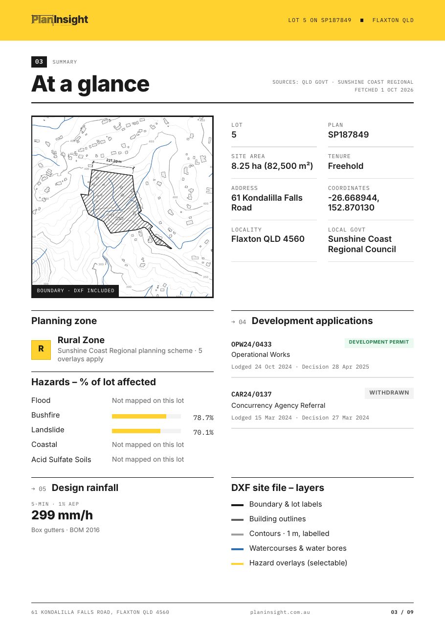
At a glance page from a Site Report with hazards as a share of the lot

The job

What a geotechnical desktop study can settle before site

Under AS 2870 the site classification comes from what you find in the ground. The desktop study decides where you look and what you should expect: how steep the lot is, whether it sits in mapped landslide or acid sulfate soils areas, whether water is close to the surface, and whether anyone has cut or filled it before.

The Site Report answers the parts that public data can. The DXF gives the boundary, contours and building outlines in metres, which doubles as a base for the borehole location plan. The hazards section lists landslide, steep land and acid sulfate soils overlays where the state or council maps them: landslide in NSW, VIC and TAS, acid sulfate soils in NSW, SA and WA, and both in several South East Queensland councils.

Watercourses and registered water bores come on their own DXF layers in most states. The DA history for the lot shows prior subdivision, earthworks or building approvals, which is often the first sign of fill.

PlanInsight does not map geology or soil types. Pair the report with your state geological survey mapping for that part of the study.

Development applications page from a Site Report with earthworks approvals on the lot

In the Site Report for geotechnical work

  1. 01

    Contours and slope

    Elevation-labelled contours from the best source the state publishes. Queensland uses 1 m LiDAR where flown, then 5 m, then 10 m SRTM.

  2. 02

    Landslide and acid sulfate soils, % of lot

    Landslide, steep land and acid sulfate soils overlays where mapped, with the share of the lot each one covers.

  3. 03

    Water near the site

    Mapped watercourses and registered water bores as DXF layers, in the states that publish them.

  4. 04

    Site history

    Development applications on the lot, to flag earlier subdivision, earthworks or demolition.

  5. 05

    A base for the borehole plan

    Boundary, buildings and contours in metres, ready to mark up in CAD.

Plan the investigation, not the surprise.

The manual way

  • Arriving on site to find a steeper lot than the listing photo suggested.
  • Checking landslide and acid sulfate soils mapping in separate portals.
  • No record of old fill or earthworks until the first borehole.
  • Drawing a borehole location plan on a blank page.

With the Site Report

  • Contours to read slope and plan access for the rig.
  • Landslide, steep land and acid sulfate soils overlays where the state or council maps them.
  • Watercourses and registered water bores near the lot.
  • A DXF base for the borehole location plan.

Guides for this work

FAQ

Questions from geotechnical engineers

Does the report give an AS 2870 site classification?

No. Site classification comes from your investigation. The Site Report provides the desktop inputs that shape it: slope, mapped landslide and acid sulfate soils overlays, water nearby and the lot's approval history.

Does it include geology or soil maps?

No. Use your state geological survey mapping for geology and soil landscapes. The report covers the planning overlays, terrain and site history.

Where is landslide mapping available?

Statewide in NSW, VIC and TAS, and from council mapping in Brisbane, Gold Coast, Moreton Bay and Sunshine Coast. Sunshine Coast also maps steep land.

Where are acid sulfate soils mapped?

Statewide in NSW, SA and WA, and from council mapping in Brisbane, Moreton Bay and Sunshine Coast.

Can I use the DXF for a borehole location plan?

Yes, as a base. It has the boundary, buildings and contours in metres, in local coordinates about the lot centroid rather than MGA.

Plan the investigation before you book the rig.