For town planners & planning consultants

Planning data for town planners,
without the portal hopping.

The planning zone, hazard overlays, the lot's DA history, title details and the council's contacts and planning links, fetched from each source and dated. One Site Report per site, before the pre-lodgement review.

One-off · no account · sources and fetch dates on every page
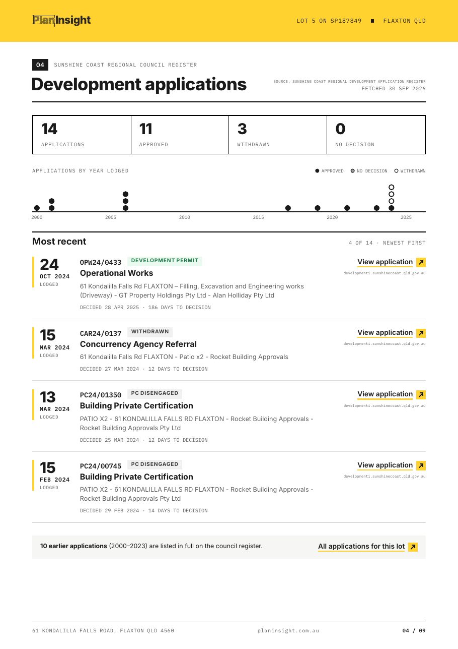
Development applications page from a Site Report with status, decision dates and council links

The job

Where planning data for a site actually lives

A pre-lodgement review touches four or five systems: the council DA tracker, the state planning portal, the cadastre, the council contact page and whatever overlay mapping the scheme uses. Each has its own search, and none of them talk to each other.

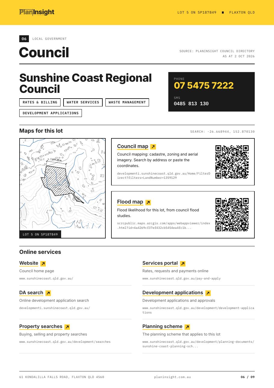
The Site Report starts from the address. It prints the zone, the overlays that touch the lot and the DA history pulled from the council's own system in supported councils, with a link to each record. The council page lists the planning scheme, DA search and contacts for the lot.

Once a site is live, a plan lets you bookmark it and get a notification when a new application is lodged or a tracked application changes status.

Council page from a Site Report with contacts, maps and planning scheme links

In the Site Report for planning work

  1. 01

    DA history with council links

    Applications on the lot with type, status, lodgement and decision dates, newest first.

  2. 02

    Planning zone

    The zone and scheme where the council publishes it. The report only promises zoning where we have confirmed it, and says so before you pay.

  3. 03

    Hazard overlays, % of lot

    Flood, bushfire, landslide, coastal and acid sulfate soils where mapped, with the share of the lot affected.

  4. 04

    Council contacts and planning links

    Phone, website, DA search, planning scheme and council maps for the lot.

  5. 05

    Title details

    Lot, plan, area and tenure from the state cadastre, so nothing gets re-keyed.

One address, every planning source.

The manual way

  • Logging into a different council DA portal for every address you assess.
  • Re-keying lot and plan numbers across the planning portal, the cadastre and your report.
  • Missing a new DA because nobody was watching that address.
  • Chasing council contact details and DA search links by hand.

With the Site Report

  • Zone, overlays, DAs and title for the address in one PDF.
  • DA history fetched from the council's own register, with links to each record.
  • Council phone, DA search and planning scheme links on one page.
  • Sources and fetch dates on every section.

Guides for this work

FAQ

Questions from town planners

Which councils do you cover for development applications?

More than 250 councils, listed on the coverage page. DAs are fetched from each council's own system when you look up a property and refreshed on demand.

Does the report show the zone for every property?

The $29 report promises zoning only for councils where we have confirmed it, and says so before you pay. With a plan, the property page shows the zone wherever the council or state publishes zoning data we can read.

Can I generate state planning reports?

With a plan, yes. From the property page you can generate the NSW Planning Portal property report, the VIC property and planning overlay reports, ACT block reports, the QLD survey plan and the TAS planning report.

How do DA notifications work?

On a plan, bookmark a property and you are notified when a new application is lodged on it or a tracked application changes status.

Can my team share properties?

Yes, on a plan. Properties, comments and tasks live in a shared team workspace. The Team plan adds the Kanban task board.

Cut the council-portal busywork.