Zoning check

What zone is the property in, and what else applies?

Search the address and see the planning zone, every overlay that crosses the lot and what the council has approved nearby. One report, dated sources, no planning portal to learn.

  • $29 incl. GST
  • One-off
  • No account
  • PDF and DXF
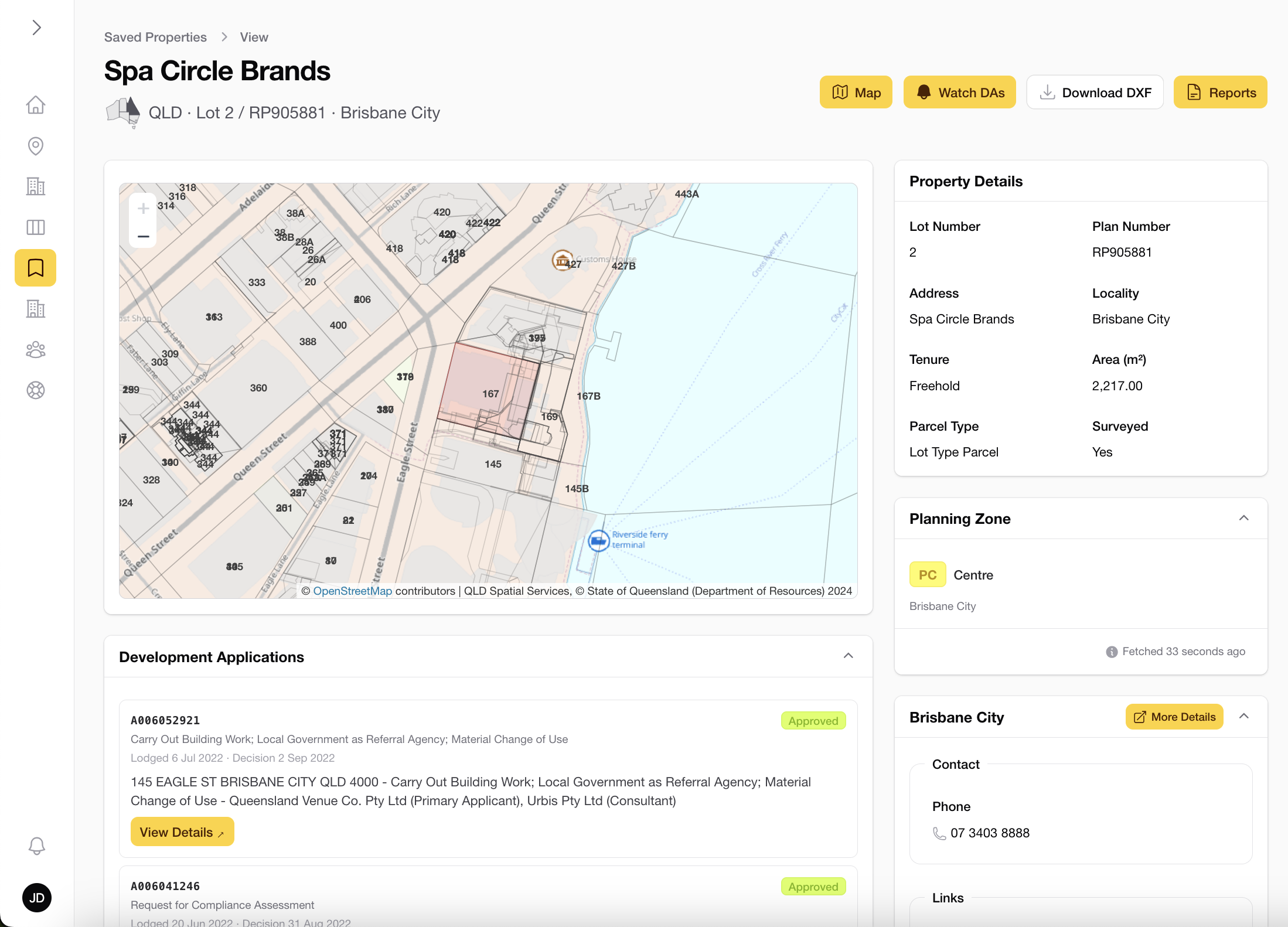
Property page showing the planning zone, overlays and lot details

What you get

The zone is the start, not the answer.

A zoning map tells you the colour of the lot. Whether you can build what you want depends on the overlays, the DAs around you and the hazards on the block. The report puts all of it on one lot.

Planning zone

The zone and planning scheme the council publishes for the lot, with the source and the date it was fetched.

Overlays on the lot

Flood, bushfire, landslide, coastal and acid sulfate soil overlays, with the share of the lot each one covers.

What the council has approved

Development applications lodged on the lot and around it, each linked to the council record.

Title and area

Lot and plan, land area and tenure from the state cadastre, so you know what you are reading about.

Land valuation

The current statutory land value for Queensland and New South Wales properties.

The site in CAD

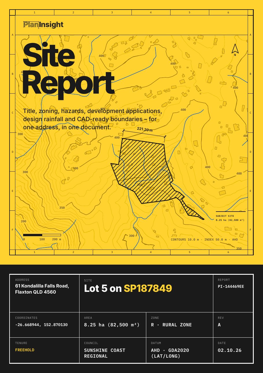
A DXF with the boundary, buildings, contours and overlays, ready for a concept plan.

Where it works

Zoning is included where we can read the council or state zoning data. In Queensland that means the councils listed on our coverage page. You see what the report will include before you pay, so there is no guessing.

Site Report · $29

Zone, overlays and DAs, in one PDF.

Everything a town planner checks before a pre-lodgement meeting, for one lot, in one order.

  • Title details: lot and plan, land area and tenure
  • Zoning, where the council publishes it
  • Flood, bushfire and other hazard overlays, where mapped
  • Development application history for the lot
  • Contours and elevation
  • Land valuation (Queensland and New South Wales properties)
  • A CAD-ready DXF: property boundary, building outlines, watercourses, water bodies, water bores, elevation contours, pathways and easements (indicative), where the state publishes them

One-off, no account. Emailed as a zip with the PDF and DXF.

FAQ

Questions

Look through the sample report first, or get in touch.

Is this the same as a planning certificate?

No. A planning certificate (a section 10.7 certificate in NSW, for example) is a legal document the council issues. This is a research report compiled from the council's and state's published mapping. Use it to decide whether to spend money on the certificate, not instead of it.

Does it tell me what I can build?

It tells you the zone, the overlays and what has been approved nearby, which is what a planner reads first. Whether a specific proposal is allowed depends on the planning scheme's tables and codes, and often on a conversation with the council.

Can I see the zone before I pay?

Where we have the zoning data, yes. Search the address, confirm the lot on the map, and the zone is shown with the list of sections the report will include. Then you decide.

What about Western Australia?

Covered. Western Australian lots get the local planning scheme zone where the council publishes it, plus contours, hazard overlays, title and DA history where the council has a register.

How current is the zoning?

Each section prints the source and the date the data was fetched. Councils update their schemes on their own schedules, which is why the date is printed rather than hidden.

Know the zone before you make an offer.

One-off · No account · PDF and DXF